A finished virtual city tour feels effortless. You click from the market square through a narrow lane, step inside the church, drift up over the rooftops, and a voice explains why the town hall carries two mismatched gables. That sense of ease is not luck. It is the visible result of a structured production process that usually runs across several weeks and demands far more coordination than a conventional photo shoot. If you commission such a project as a municipality, a tourism board, or a city marketing organisation, it pays to understand what sits behind the polish, not so you can operate the cameras yourself, but so you can judge proposals realistically, reserve the right internal resources, and set honest expectations with your committee.
This article walks through the full production path, from the first route sketch to the moment the tour goes live on your website. It is written for the people who actually prepare or tender these projects: staff in tourism, economic development, and public relations. The emphasis throughout is on the decisions that genuinely sit in your hands. Which places belong on the route? Who supplies the text? How many languages? Where will it be hosted? Those questions shape effort, cost, and quality far more decisively than the choice of camera hardware ever will.
Planning the Route and Points of Interest With the Tourism Board
Nothing about a good tour begins with a camera. It begins with a map. In a kick-off workshop, typically two to three hours with the tourism board, city marketing, and often the municipal archive or the heritage-conservation office, you decide which points the tour should show and in what order visitors will experience them. For a mid-sized town, the sensible scope tends to land between fifteen and thirty points of interest. Fewer feels patchy and incomplete. More overwhelms the navigation and pushes both production and maintenance effort up without a matching gain in value.
Selection works best against three clear criteria. The first is tourist relevance: what do guests already look for, and what already appears on your printed town map? The second is narrative connection. A tour is not a catalogue but a sequence, and a sequence needs a thread, whether that is medieval urban development, industrial heritage, or a thematic spine such as "water in the city". The third criterion is practical accessibility. A courtyard that opens only three days a year can be a genuine highlight, but it introduces scheduling risk that has to be planned in early rather than discovered late.
The workshop produces a route document with a map view, numbered viewpoints, access notes, and a named contact for each point of interest. This document becomes the central steering instrument of the whole project. It also records where the connecting points between stations will sit, meaning the intermediate captures along streets and paths that create the feeling of a continuous walk rather than a set of disconnected stops. A spacing of roughly eight to fifteen metres between panorama positions is typical: close enough for smooth click-through movement, far enough apart to keep the data volume manageable. In parallel, you clarify which surfaces are privately owned and where entry or filming permissions have to be secured before anyone sets up a tripod.
The Reality Outdoors: Weather, Light, and Seasons
The single biggest difference between interior and exterior capture is the loss of control over light. Indoors you can add lighting; outdoors your only real lever is choosing the right window of time. For a coherent tour, one rule governs everything: every capture should happen under conditions as similar as possible. Nothing looks more amateurish than a tour where the market square bakes in hard sunlight while the neighbouring lane sits under a slab of grey cloud. The jump between two such panoramas instantly destroys the illusion of one continuous space, and no clever editing fully repairs it afterwards.
In practice this means a lightly overcast sky is the ideal state. It delivers soft, even light with no harsh cast shadows and no blown-out patches of sky. Direct midday sun in tight old-town lanes produces a contrast range that even bracketed HDR exposures can only rescue with visible compromise. Early mornings, by contrast, offer not only pleasant light but also the lowest pedestrian density, a double advantage that often pulls the shooting window into the hours between roughly six and ten in the morning. That timing choice is not a stylistic preference; it directly reduces the privacy work required later.
The season is a strategic decision that has to be agreed with the client early. Leafy trees hide facades, while bare branches read oddly in summer-holiday marketing. Late spring and early autumn are usually the best compromise: vegetation present but not overgrown, light still soft, and the tourist season not yet at its peak. A realistic production plan therefore builds in buffer time rather than pretending the weather will cooperate. For a route of twenty points of interest, you would normally budget three to five effective shooting days spread across a window of three to six weeks, so that weather-driven postponements can be absorbed. Cut that buffer and you are simply buying quality problems in advance.
People in the Frame and GDPR-Compliant Blurring
A town centre is a busy place, and that is exactly as it should be. A completely deserted tour feels sterile and slightly haunted. At the same time, every recognisable person in a 360-degree panorama is processing of personal data in the sense of the GDPR. The production process has to resolve this tension, and it does so in two stages: first through avoidance during capture, then through technical anonymisation in post-production. Treating the second stage as a substitute for the first is a common and expensive mistake.
Avoidance in concrete terms means early shooting times, steering clear of market days and events, short waits until passers-by have left the capture zone, and, on especially busy squares, taking several exposure series that can later be combined into a largely people-free result. No serious workflow relies on avoidance alone, but any person who never enters the raw material in the first place is a person you never have to blur, and that keeps the later effort proportionate and the results cleaner.
The second stage is automated blurring of faces and vehicle number plates, followed by a manual quality check. Automatic detection is reliable but not flawless. People seen in half profile, reflective shop windows, children in prams, or faces on advertising posters routinely cause errors in both directions, whether missed subjects or falsely blurred objects. A review pass through every panorama is therefore a mandatory part of the process, not an optional extra. Alongside this, it is worth considering signage or a short announcement through the municipal channels during the preparation phase. This is not legally mandatory in every case, but it creates transparency and heads off complaints. For documentation, a short processing-record note that the municipality can present on request is a sensible safeguard. Sensitive settings such as school yards, nurseries, medical practices, or residential entrances are ideally flagged in the route document in advance as areas to keep out of frame entirely.
Combining Three Perspectives: Street Level, Aerials, and Interiors
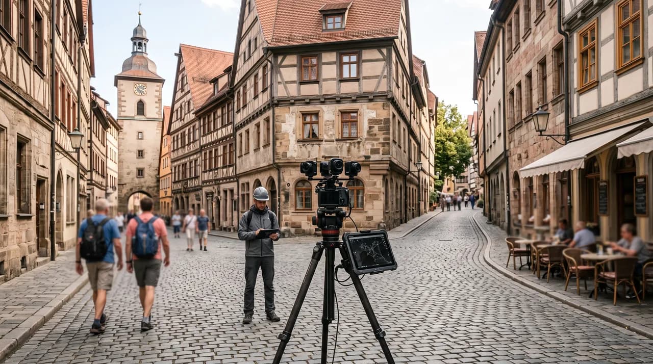
A convincing city tour lives on the change of perspective. The foundation is 360-degree capture at street level: eye-height panoramas taken with high-resolution camera systems and exposure brackets that hold detail in both the bright sky and the shaded arcades. This layer creates the feeling of actually walking. It is also the most labour-intensive, because every single viewpoint has to be reached, levelled, aligned, and documented individually before the operator moves to the next position along the route.
The second layer is aerial imagery. Drone panoramas from thirty to one hundred metres up deliver the orientation that is missing at street level. How does the old town sit in the river valley? Where does the city wall run? A cleanly placed transition from a ground panorama up to an aerial panorama is among the most striking moments a tour can offer. Legally, drone flights over town centres are demanding. They involve flight approvals, operating permissions for flying above gatherings of people, coordination with the aviation authority, and sometimes the control zones of nearby airports. These approvals need lead time, frequently several weeks, which is exactly why they belong at the start of project planning and never at the end.
The third layer is interior scans of the landmark buildings: the church, the town hall, the museum, a historic hall, sometimes a railway station or a cultural centre. Here 3D scanning comes into play, producing not just panoramas but a walkable spatial model complete with a floor plan and measurement function. The effect for users is considerable, turning a tour that goes around the buildings into a tour that goes through the city. For the municipality there is an often underestimated side benefit: the interior scans double as a digital record of the current state, reusable for heritage conservation, event planning, or renovation preparation. The three layers are stitched together in post-production through carefully placed transition points, so the shift from street to sky to interior is experienced as an expansion rather than a jarring break.
Multilingual Audio Guides and Information Tags
Images alone do not tell a city's story. The content layer emerges from information tags and audio texts anchored to the panoramas. A tag might be a short block of text, a historic photograph for comparison, a link to the museum's opening-hours page, an embedded video, or an audio segment of forty-five to ninety seconds. That length has proven practical: long enough to carry a real piece of information, short enough that few listeners drop out before the end. Placed well, these tags turn a pretty walk-through into something people learn from and return to.
Text production is the point where projects most often stall, and almost always on the client side. Authority over the facts sits with the municipal archive, the tourism board, or knowledgeable local authors; no one else can say reliably in which year the tower burned down. A clear sequence works best here. The service provider supplies a text template with character limits per point of interest, the municipality fills it in with the substance, and an editorial pass brings the texts to a consistent tone and an audible sentence length. Only then does voice recording happen. Fact corrections made after the recording session are expensive, because they trigger a fresh studio session, so accuracy before the microphone is switched on saves real money.
For languages, a staged expansion is the practical approach. German and English form the base, and further languages follow the actual origin markets of your visitors, which for many German towns means Dutch, French, Polish, or Czech. What matters is that the language switch inside the tour covers every layer: menus, tag labels, texts, and audio tracks. A half-translated interface reads as unfinished within seconds. Technically, the language structure should be laid out from the outset so that further languages can be added later without rebuilding the tour, which saves substantial cost whenever the project is extended down the line.
Accessibility as a Project Driver, Not a Box to Tick
For public bodies, digital accessibility is legally binding, and a virtual city tour hosted on a municipal website falls squarely within that scope. On paper that is a requirement. In practice it is frequently the strongest content argument for the entire project. A virtual tour opens up places that are not physically accessible to everyone: the tower climb up a hundred and eighty steps, the cramped crypt, the upper floor with no lift. For people with limited mobility this is not a consolation prize but a genuine gain, and it reframes the tour from a marketing asset into a public service.
Technically, accessibility inside the tour means several concrete things. Full operability by keyboard, visible focus indicators, sufficient contrast in the interface, text alternatives for all image content and tags, captions or transcripts for audio and video, and a sensible reading order for screen readers. Motion-heavy transitions should be reducible, because automatic camera movements can trigger dizziness in some users. None of these requirements can be bolted on afterwards without pain; they belong in the specification from the beginning, where they cost little, rather than in a retrofit, where they cost a great deal.
An often overlooked dimension is the link to real-world accessibility. A tour that states, per point of interest, whether an entrance is step-free, where accessible toilets are located, or how wide a passage is becomes a planning tool for the journey itself. With interior scans, door widths and ramp gradients can be read straight from the model and stored as information. In doing so, the municipality does more than satisfy a rule. It delivers a service that is measurably used and that, importantly, tells well in communication with residents, guests, and the press.
Hosting and Embedding on the Municipal Website
Once production wraps, the question of operation begins. Virtual tours are data-intensive. A tour with twenty-five points of interest, aerial imagery, and several interior scans quickly runs to several gigabytes of image data that must be delivered quickly to viewers anywhere. Self-hosting on the municipal web server is technically possible but rarely sensible. The common approach is delivery through a content delivery network with progressive loading: a low-resolution preview appears first, then the panorama sharpens as the full data arrives. For perceived loading time, and therefore for whether people stay, this behaviour is decisive.
Embedding is usually done via an iframe on a dedicated landing page of the municipal website, complemented by a full-screen direct URL for social media, QR codes, and newsletters. Four points matter enough for municipal clients that they belong in the contract. First, an EU server location and a data-processing agreement. Second, a cookie-light or consent-free delivery, so the tour does not vanish behind a consent banner before anyone can use it. Third, anonymised usage statistics that reveal which points of interest are actually opened. Fourth, clarity over the usage rights to the raw material, so the municipality remains able to act even if it later changes provider.
Operation also means maintenance. Opening hours change, museums relocate, building sites disappear. A tour without a maintenance concept visibly ages within two to three years. A workable arrangement is an annual update allowance for text changes and tag adjustments, plus a defined reshoot scope for individual viewpoints, for example after a completed square renovation. Municipalities that carry this line item in the budget from the outset avoid the familiar situation in which a well-made project slowly loses credibility for want of a small adjustment budget that was never reserved.
Timeline and Coordination With the City Administration
A realistic overall timeline for a mid-sized city tour runs from ten to sixteen weeks between commission and go-live. The distribution typically looks like this: one to two weeks for the workshop and route document, two to four weeks for permissions, access arrangements, and drone clearances, three to six weeks for the capture including a weather buffer, three to four weeks for post-production, anonymisation, and stitching, and, running in parallel, two to four weeks for text, translation, and voice recording. A final one to two weeks covers testing, the accessibility check, and sign-off before launch.
The critical path almost never runs through the technology. It runs through coordination. Administrative processes have their own rhythms. Committee sessions happen monthly, permissions move through specialist departments, church parishes and museum directors are independent partners with their own calendars, and holiday periods can stretch approval loops by weeks. A project that starts in June and aims to go live for the season opening the following spring is realistically planned. A project that starts in March and expects to be finished by early summer usually is not, however capable the production team may be.
What accelerates the process most is a clearly named project lead on the client side with decision-making authority for day-to-day matters. This person bundles feedback, coordinates access, chases the text delivery, and serves as the contact for short-notice date changes when the weather turns. A brief standing meeting helps too; twenty minutes a week is enough, alongside a shared review environment where interim results can be commented on directly. Collected sign-offs against clear deadlines are far more efficient than scattered individual responses arriving from several departments that contradict one another and leave the provider unsure which instruction to follow.
Conclusion
A virtual city tour is not a photo assignment but a media project with content, technical, and organisational dimensions. The real difference in quality is decided before the first capture: in a thought-through route with a narrative thread, in permissions cleared early, in a weather buffer that protects visual consistency, and in clearly assigned responsibility for texts and approvals. The technology involved, whether 360-degree capture, drone panoramas, or 3D interior scans, is manageable. The coordination is the genuine achievement, and it is where good providers earn their fee.
For municipalities, tourism boards, and city marketing organisations, the effort repays itself twice over. Outward-facing, it creates an offer that convinces guests before they travel, removes barriers, and generates lasting attention in both search engines and social channels. Inward-facing, it produces a digital record that can be reused for heritage conservation, location marketing, event planning, and resident information. Set the project up with a realistic ten-to-sixteen-week timeframe, a named project lead, and a maintenance budget planned from the start, and you do not end up with a campaign image of short half-life. You end up with an infrastructure that carries value for years.