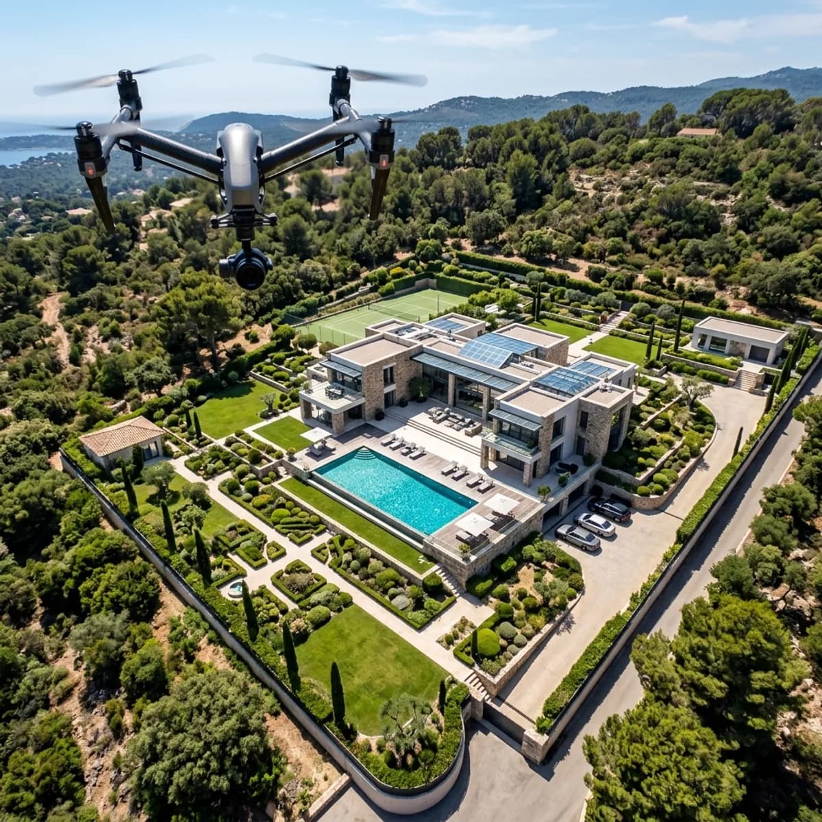
Aerial images have become part of the standard repertoire for land, commercial properties and larger residential developments. They show plot shape, connections and setting in a way that is impossible from the ground, and on construction projects they supply a recurring viewpoint for progress documentation.
What is regularly underestimated: drone operation is comprehensively regulated across the EU, the requirements apply in full to commercial use, and responsibility does not rest with the pilot alone. Anyone commissioning or carrying out aerial photography as an agent, developer or property manager should understand the basic structure of the rules.
This article sets out the essential requirements. It is a general orientation drawn from practice and does not replace legal advice; the rules are also adjusted on an ongoing basis, so the version currently in force is what governs.
The framework: the EU drone regulation
Since the European rules for unmanned aircraft came into force, a single framework has applied across all member states. It largely replaces the earlier national distinction between private and commercial flying with a risk-based approach.
What governs is no longer primarily whether money is earned from the images but what risk the specific flight creates. The determining factors are the weight and technical class of the drone, the proximity to uninvolved people, the area overflown and the flight altitude.
Operations are assigned to three categories: open, specific and certified.
The open category covers low-risk flights. It requires visual line of sight to the drone, a maximum altitude of 120 metres above ground, no carriage of dangerous goods and no dropping of objects. The great majority of property photography falls within it. The open category is further divided into subcategories, which differ mainly in how close to uninvolved people and to built-up areas flying is permitted – depending on the weight and class marking of the drone.
The specific category applies where the conditions of the open category cannot be met: flights beyond visual line of sight, over assemblies of people, at greater altitude or with heavier equipment. It requires an operational authorisation or operation under a standard scenario and involves considerable lead time.
The certified category concerns high-risk operations and plays no part in property photography.
For practice this means: a typical property assignment can be carried out in the open category, provided location, surroundings and equipment fit together. As soon as one of those does not fit – for instance because the flight would be over a busy city-centre area – the assignment becomes onerous.
What the pilot must be able to demonstrate
Basic obligations apply regardless of category.
Registration as an operator. Anyone operating a drone with a camera must register as an operator; the number issued must be affixed to the aircraft and entered into the remote identification system, where the aircraft has one.
Proof of competence. Depending on subcategory and weight, an online proof or a more extensive remote pilot qualification with a practical assessment component is required. Which proof suffices depends on the specific operating profile – proof at the lowest level is often not enough for flights near residential buildings.
Liability insurance. Insurance is compulsory for the operation of unmanned aircraft. What matters is that the policy covers the actual purpose of use. A standard private liability policy does not as a rule cover commissioned commercial work, and some policies exclude flights over built-up areas.
Knowledge of local conditions. Before every flight, the geographical restrictions applying at the site must be checked. That check belongs to the flight, not to the memory of the last assignment.
The practical consequence for you as the client is simple: ask for proof of registration, proof of competence and confirmation of insurance before the assignment. A provider who cannot supply these documents within one working day probably does not have them.
No-fly and restricted zones
Geographical zones with flight prohibitions or operating restrictions are binding and they change. Typically affected are areas around airports, airfields and special landing sites, nature and bird protection areas, certain industrial installations, trunk roads and railway installations, areas around public authorities, police and judicial facilities, military installations, and hospitals and emergency response sites.
These zones can be checked via official mapping and information systems. The currency of the check matters: temporary restrictions may be in force, for instance around events, emergency operations or works on transport routes.
Two points are frequently overlooked. First, the restrictions are three-dimensional – an area may be open up to a certain height and closed above it. Second, the restriction applies where the drone flies, not where the pilot stands. Taking off outside a restricted zone does not make entering the zone permissible.
On top of the aviation-law level comes the question of the take-off site. Taking off from a plot of land requires the consent of the person entitled to dispose of it; on public land municipal rules may apply, and parks and green spaces frequently have their own by-laws.
Personality rights and data protection
Most practical conflicts arise here, and they are to be assessed independently of aviation law.
A camera in the air inevitably captures more than the target property. Neighbouring plots, gardens, terraces, windows, vehicles and people end up in the image. It becomes critical when the camera visibly looks into protected areas – into an enclosed garden, onto a roof terrace, through windows into living spaces. Such images intrude into the privacy of those affected, regardless of whether the flight was permissible under aviation law.
A clear practice follows for publication: neighbouring plots should not be recognisable in detail, people and vehicle registration plates belong obscured, and images reaching into protected areas are not used. Where neighbouring buildings are close, a brief conversation beforehand is the cheapest safeguard.
In data protection terms, note that aerial images can contain personal data – not only through people depicted but also through the attributability of a plot to its occupants. Processing requires a legal basis, and the images should not be retained longer than the purpose requires.
Copyright in depicted buildings is a separate point. Freedom of panorama permits images taken from publicly accessible routes. Whether it covers aerial images is contested and has been the subject of litigation. Restraint is therefore appropriate with distinctive third-party buildings protected by copyright.
Who is liable
Formal responsibility for the flight lies with the operator or the remote pilot. They carry responsibility for compliance with the category, the zone restrictions, the separation distances and the documentation.
What is relevant for you as the client is that this responsibility cannot be fully delegated. Anyone commissioning a service provider without checking their qualification and insurance, where that would readily have been possible, can be drawn into responsibility. Added to this is responsibility for the use of the material: anyone publishing an image that infringes personality rights is liable for the publication – even where the flight itself was permissible.
The practical safeguard therefore consists of two steps: obtain the documents before the assignment, and review the delivered material before publication.
What the commission should set out
Alongside the documents, it is worth recording several points in writing.
Clarify the usage rights: for which property, in which media, for what duration, whether you may edit the material and pass it on to portals, sales partners or the press. The last point is most often overlooked and surfaces precisely when things are urgent.
Clarify delivery: resolution, file formats, whether raw data or only edited images are supplied, and how much post-production is included.
Clarify the weather dependency: aerial images depend on wind, precipitation and visibility. An agreement on fallback dates prevents arguments.
And clarify who checks the permissions situation. For properties in sensitive locations this is a work step of its own with lead time.
Limits and typical mistakes
"I'm only flying briefly over my own plot" does not hold. The rules attach to the flight, not to ownership of the ground. Category, altitude limit, separation rules and zone restrictions apply over your own land as well.
Marketing flights are not private. An agent promoting their own property is acting in the course of their professional activity. The idea that only someone selling the images is acting commercially is a widespread misconception with consequences for insurance.
Insurance is the most common weak point. Existing commercial or private liability policies frequently do not cover drone operation. Check not merely whether a policy exists but whether it covers the specific assignment.
A zone check does not stay valid. Restrictions change and temporary closures are added. The check belongs immediately before the flight.
Not every property benefits. For flats in apartment blocks and in dense terraced housing, the aerial view mainly shows the neighbours' roofs. The value lies with land, commercial and logistics properties, properties with a locational advantage, and construction progress documentation.
Raw material is not ready to publish. Between a permissible flight and a permissible publication lies the review: recognisable people, registration plates, views into neighbouring plots.
Lead time is underestimated. Assignments in restricted zones require coordination. Anyone needing an image for marketing next week does not have that lead time.
Conclusion
Drone photography is legally manageable but not free of preconditions. The framework of the EU drone regulation is risk-based: category, weight, distance from people and zone restrictions determine what is permissible. Registration, proof of competence and suitable insurance are basic requirements, and checking the zone situation belongs immediately before every flight.
The second area, often underestimated, lies outside aviation law: personality rights and data protection decide whether a lawfully created image may also be published. That assessment rests with whoever publishes.
For clients this reduces to two actions: obtain the documents before the assignment and review the material before publication. Both take a few minutes and replace the disputes that otherwise arise.
You will find the scope of services under drone photography.