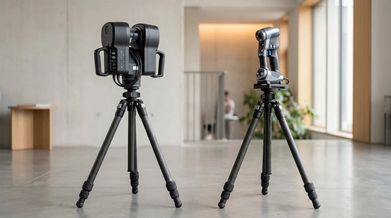
Anyone commissioning a 3D capture project sooner or later runs into the same question: does this job call for a Matterport-style tour, a survey-grade laser scan, or both? The answer is not a matter of brand preference. It comes down to what the resulting data needs to do once the camera or scanner has left the building. A leasing tour and a renovation drawing set are built from fundamentally different kinds of geometry, and understanding that difference upfront saves budget, rework, and awkward conversations three weeks into a project.
This article breaks down the two dominant capture approaches on the market today — structured-light/photogrammetry devices in the Matterport Pro3 category, and professional LiDAR laser scanners in the Leica BLK360 class — without favouring one brand over another. The goal is to give facility managers, architects, and property developers a working mental model they can apply the next time a capture decision lands on their desk.
Two Different Measurement Principles
Matterport-class devices work by combining a rotating camera array with an infrared depth sensor. As the device spins through a series of positions in a room, it captures overlapping photographs and depth readings, then stitches them together into a 3D mesh using structured-light triangulation and photogrammetric alignment. The strength of this approach is that it produces a visually rich, textured model very quickly, because the underlying goal is a convincing spatial representation rather than a survey-grade point cloud. The depth sensor is good enough to place walls, furniture, and openings believably in space, but it was never designed to compete with dedicated metrology hardware.
Leica BLK360-class scanners take a different path entirely. They use time-of-flight or phase-shift LiDAR, firing laser pulses in a dense spherical pattern and measuring the return time (or phase difference) of each pulse to calculate distance with sub-centimetre precision. A single scan position can generate several million individual points, each with an accurately measured XYZ coordinate. Multiple scan positions are then registered together — either automatically via visual odometry and target recognition, or manually by an operator — into a single, dimensionally accurate point cloud that can span an entire building.
The practical consequence of these two measurement principles is that one produces a model optimised for visual navigation and general spatial understanding, while the other produces a dataset optimised for precise measurement and downstream engineering use. Neither principle is superior in the abstract; they simply target different outputs, and mixing up which one a project actually needs is the single most common cause of disappointment on either side.
Accuracy and Tolerance: What the Numbers Actually Mean
Accuracy claims are where most confusion starts, because both technologies publish numbers that sound similar on a spec sheet but mean very different things in practice. A structured-light device's depth accuracy is typically expressed as a percentage error that grows with distance and is affected by surface material, lighting conditions, and reflective or transparent surfaces such as glass and mirrors. For general layout capture — confirming that a room is roughly the shape and size it appears to be — this is entirely adequate. For anything requiring dimensional certainty at the level of individual millimetres, it is not.
A professional LiDAR scanner's accuracy is specified as an absolute distance tolerance, often in the low single-digit millimetre range at typical working distances, with a controlled degradation curve as distance and angle of incidence increase. This is the level of tolerance that structural engineers, MEP coordinators, and CAD/BIM teams actually require, because their downstream deliverables — clash detection, as-built drawings, retrofit calculations — depend on the point cloud being trustworthy at the same precision the design software itself operates at.
The practical takeaway for anyone briefing a capture project is to ask not "how accurate is this device" but "what tolerance does my deliverable require, and does the proposed method meet it with margin to spare." A leasing tour has effectively no tolerance requirement beyond looking correct. A renovation drawing set for a load-bearing wall has a tolerance requirement measured in millimetres. Choosing the capture method backwards from the deliverable, rather than forwards from whichever device is on hand, avoids the majority of accuracy disputes after the fact.
Speed and Ease of Use on Site
One of the reasons structured-light devices have become so widely adopted for commercial and residential marketing is the sheer speed of on-site capture. A typical apartment or small commercial unit can be fully scanned in well under an hour by a single operator with minimal training, and the device largely handles alignment and stitching automatically in the cloud afterward. There is no need for reflective targets, no lengthy setup per scan position, and very little post-processing judgement required on site — the workflow is close to point-and-shoot.
Professional LiDAR scanning is a more deliberate process. Each scan position needs to be planned so that overlapping coverage allows clean registration, and larger or more complex buildings may require dozens of individual scan positions to eliminate occlusion shadows behind columns, furniture, or partition walls. Registration — the process of aligning all scan positions into one coherent coordinate system — takes real processing time and, on complex sites, benefits from an operator who understands how to spot and correct alignment drift before it propagates through the model.
This difference in operational tempo has direct budget implications. A single-room retail unit destined for a marketing tour might reasonably be captured in the time it takes to walk through it twice, while a multi-storey office building being surveyed for a full MEP retrofit could involve a full day or more on site plus meaningful desk time afterward. Neither pace is a flaw — they simply reflect the amount of measurement rigour being built into the raw data at capture time, which is exactly the trade-off that determines cost.
Cost Structure: Where the Money Actually Goes
Structured-light capture is generally the more economical option per square metre, and that economy comes from genuine efficiencies rather than corner-cutting: faster on-site time, largely automated cloud processing, and a delivery format built for straightforward web and mobile consumption. For portfolios that need dozens or hundreds of units captured on a recurring basis — a property manager refreshing listings seasonally, for instance — this cost profile is what makes routine, wide-scale capture financially viable at all.
LiDAR-based surveying carries a higher cost per square metre, and understanding why avoids the impression that it is simply the pricier option for the same result. The cost reflects specialised hardware with a materially higher acquisition and maintenance cost, longer on-site time per square metre, and — critically — a level of operator expertise in scan planning, registration quality control, and point cloud cleanup that a purely photographic workflow does not require. Much of that cost is invested precisely in the accuracy margin discussed earlier, and it shows up later as fewer site revisits, fewer clarification requests during design, and drawings that survive contact with a construction crew.
The cost comparison only becomes meaningful once it is anchored to the deliverable. Comparing per-square-metre prices without reference to what each euro is buying — a walkthrough experience versus a certified measurement dataset — leads to false economy in both directions: overpaying for LiDAR precision nobody downstream will use, or underpaying for a marketing scan and then discovering it cannot support a renovation permit application.
Where Structured-Light Capture Wins
Marketing and leasing is the use case structured-light devices were essentially built for. A virtual dollhouse tour lets a prospective tenant or buyer explore a space remotely with genuine spatial intuition — far beyond what static photography or a floor plan can convey — and it does so at a price point that makes sense even for a single residential unit or small commercial space. For estate agents, asset managers, and hospitality operators, this is often the entire business case for 3D capture.
Beyond pure marketing, these tours are increasingly used as an internal documentation layer: a quick visual record of a space's condition at handover, a reference for facilities teams trying to remember where a particular junction box or access panel sits, or a shareable walkthrough for stakeholders who cannot visit a site in person. None of these applications require dimensional certainty; they require a fast, low-friction, visually convincing representation of the space as it existed on the day of capture.
Where structured-light capture genuinely struggles is in poor lighting, highly reflective environments, and very large or geometrically complex spaces where depth-sensor range and stitching accuracy begin to degrade. It is also, by design, not the tool to reach for when the deliverable needs to interface with CAD or structural engineering software at anything beyond an approximate massing level.
Where Professional LiDAR Scanning Wins
Any project feeding into CAD or BIM workflows — architectural retrofit, structural assessment, MEP coordination, facade documentation, historic building preservation — belongs in LiDAR territory. These workflows depend on point clouds that can be trusted at the same tolerance the design software operates in, and on the ability to extract accurate cross-sections, elevations, and clash-detection geometry directly from the scan rather than from an approximated mesh.
Construction documentation is another clear case. As-built surveys used to verify that a completed structure matches its design intent, or to document conditions before a renovation begins, need a defensible, millimetre-accurate record — not an approximation that looks right on screen. The same applies to facility management use cases involving structural monitoring, deformation tracking over time, or any scenario where two scans taken months apart need to be compared with confidence that any detected change is real and not measurement noise.
The trade-off is the one already covered: more time on site, higher per-square-metre cost, and a workflow that assumes downstream users — architects, engineers, surveyors — who know how to work with a registered point cloud. For projects where that level of precision is not actually required, this is simply more capability than the deliverable calls for.
Data Formats and Downstream Usability
Structured-light platforms typically deliver their output through a proprietary cloud viewer optimised for web and mobile playback, alongside export options such as OBJ meshes, panoramic imagery, and simplified 2D floor plans. These formats are well suited to viewing, sharing, and light editing, but they are not built as precision measurement sources — importing them into CAD software yields a usable spatial reference, not a certified dataset.
LiDAR scanners export in point cloud formats such as E57 or PTS/PTX, which are the industry-standard interchange formats accepted directly by CAD, BIM, and point cloud processing software. This is what allows a surveyor's scan to flow directly into an architect's Revit model or a structural engineer's analysis package without an intermediate translation step that could introduce error. Registered point clouds can also be converted into 2D CAD drawings, 3D solid models, or true orthophotos — deliverables that a photogrammetric mesh cannot reliably produce.
This difference in downstream compatibility is often the deciding factor in practice, even before accuracy is discussed. If a project's next step involves an architect or engineer opening the file in professional design software, the data needs to arrive in a format and tolerance that software expects. If the next step is a client opening a link in a browser, the priorities reverse entirely.
When Combining Both Makes Sense
The two technologies are not mutually exclusive, and on larger or more complex projects, combining them is often the most efficient route rather than a compromise. A common pattern is to commission a full LiDAR survey for the technical deliverables — CAD drawings, BIM models, structural documentation — while separately capturing a structured-light tour of the same space for marketing, leasing, or stakeholder communication purposes. The two datasets serve entirely different audiences and rarely need to be reconciled with each other.
Another pattern involves phased projects: a structured-light tour early on to support fast decision-making, tenant marketing, or remote stakeholder review, followed by a targeted LiDAR survey once a renovation or construction phase is actually greenlit and precise measurements become necessary. This sequencing avoids paying for survey-grade precision before it is needed, while still ensuring it is available the moment the project moves into a phase that requires it.
The practical advice for anyone weighing this decision is straightforward: define the deliverable before choosing the capture method. Ask who will use the data, what software it needs to open in, and what tolerance that use case genuinely requires. A capture partner who asks these questions before recommending a device is generally a more reliable signpost than any spec sheet comparison.
Conclusion
Matterport Pro3-class structured-light capture and Leica BLK360-class LiDAR scanning are not competing answers to the same question — they are the right answers to two different questions. One optimises for speed, cost-efficiency, and visual navigability, making it the natural choice for marketing, leasing, and general documentation. The other optimises for dimensional certainty and CAD/BIM compatibility, making it the necessary choice wherever engineering, construction, or precise as-built documentation is involved. The projects that go smoothly are the ones where this distinction is made at the briefing stage, not discovered after the data has already been delivered — and on larger projects, using both technologies for what each does best is often the most cost-effective path of all.