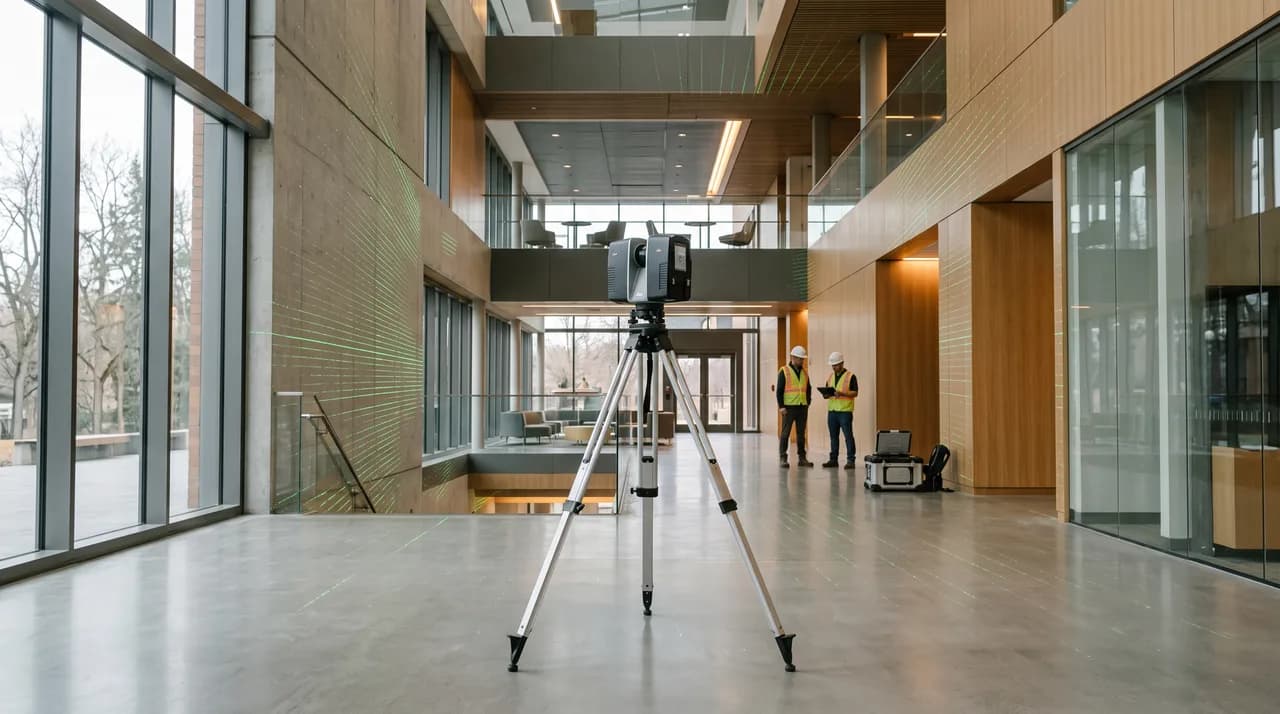
In just a few years, the 3D surveying of buildings has evolved from a specialist discipline reserved for surveying engineers into an everyday tool across architecture, real estate, facility management and construction planning. Where folding rules, laser distance meters and hand-drawn measurement sketches once set the standard, laser scanners and camera systems now capture millions of precise measurement points of a building within just a few hours. From this data emerge digital replicas that can be analysed, measured and processed further in planning software at will.
For many clients, however, the subject remains hard to grasp. Terms such as point cloud, LiDAR, registration and BIM model are often used interchangeably or imprecisely, and the range of available methods stretches from inexpensive walkthrough cameras to high-precision surveying scanners with markedly different results. This guide provides a comprehensive tour of the entire field of 3D building surveying: from the physical measurement principles, through the typical course of a project, to the deliverables, accuracy tiers and the question of how to specify a survey sensibly and select the right provider. The aim is an accessible yet substantial overview that ties the individual facets of the topic together.
What 3D building surveying actually is
3D surveying refers to the three-dimensional capture of an object's geometry — in the context of buildings, that means the spatial recording of walls, ceilings, floors, openings, façades and technical installations. Unlike traditional hand measurement, where individual distances are measured selectively and then interpreted into a drawing, 3D surveying captures the entire visible surface comprehensively. The result is initially not a plan but a digital replica of reality in the form of measurement points or images, which is evaluated later.
The decisive advantage lies in completeness and traceability. A conventional survey captures only what the surveyor deliberately measured; everything else is missing. A 3D scan, by contrast, documents the complete recordable as-built condition at the moment of capture. If it emerges months later that an additional dimension is needed — the height of a door opening, say, or the distance between two columns — that measurement can be taken retrospectively from the data without having to return to the site. The scan thereby becomes a digital twin of the actual condition.
It is important to understand that 3D surveying is an umbrella term for very different technical approaches. A quick walkthrough capture with a panoramic camera and an engineering-grade recording with a terrestrial laser scanner are worlds apart in terms of accuracy, effort and intended use. Anyone commissioning a 3D survey should therefore ask less about the technology than about the objective: what should the data ultimately be used for? That answer determines which method and which accuracy are actually required.
Measurement principles: how sensors capture spaces
At its core, every optical 3D capture relies on determining, for each recorded surface point, its distance to the sensor and its direction. Distance and direction together yield a three-dimensional coordinate. When it comes to how that distance is measured, the common technologies differ fundamentally, and these differences also explain their respective strengths and limitations.
The principle that currently dominates professional building surveying is time-of-flight measurement, also known as LiDAR. The scanner emits a laser pulse and measures the time the light takes to return as a reflected signal. From this travel time and the known speed of light, the distance is calculated. A rotating mirror systematically steers the beam across the entire surroundings, so that a single scan position delivers a very large number of points per second in a short time. Time-of-flight methods work over long ranges of several tens of metres and are therefore suitable for entire buildings, halls and façades.
A second widely used principle is structured light. Here a known light pattern is projected onto the surface, and the geometry is calculated from how this pattern is distorted as seen by a camera from a different angle. Structured-light scanners achieve very high detail resolution at short range and are used above all where fine surface structures matter — for objects, components or in heritage conservation. For capturing entire buildings they are less suitable because of their limited range. Alongside these sits photogrammetry, in which a 3D model is derived computationally from many overlapping photographs — an approach that needs no active light source but does require good lighting conditions and sufficient image overlap.
For practical assessment, it is important to note that none of these principles is categorically superior. Time-of-flight methods score on range, speed and independence from lighting conditions, but reach their limits at transparent or highly reflective surfaces, where the laser beam is deflected or fails to return at all. Structured-light systems deliver the finest detail but require many closely spaced recordings and are uneconomical for large areas. Photogrammetry is particularly flexible and inexpensive — for instance, using drones for façades and roofs — but depends heavily on capture quality and processing software. In practice, these methods are therefore often combined to exploit their respective strengths and to offset the weaknesses of one with another.
The 3D surveying workflow, step by step
A professional surveying project follows a structured workflow that begins long before the actual scan. It starts with scan planning. Here it is determined which areas must be captured at what accuracy, where the scan positions lie in order to avoid occlusions, and which reference points will later serve to link the data together. Good planning is decisive for quality and efficiency: if positions are chosen poorly, data gaps arise that can only be closed by a return visit.
Next comes the actual on-site data capture. For larger objects, scanning is carried out from numerous positions, sometimes supplemented by aerial imagery or detail scans of individual areas. Each position delivers its own point cloud in a local reference system. The next step, registration, brings these individual scans together into a common coordinate system, so that a continuous, dimensionally accurate overall model of the building results. The accuracy of this linkage is monitored via statistical metrics; for complex objects it is frequently the most demanding part of the pre-processing.
After registration, the point cloud is cleaned: measurement noise, reflections off glass surfaces, phantom points and moving disturbances such as people or vehicles are removed. Only then does the derivation of the actual deliverables begin. Depending on the commission, this produces a cleaned point-cloud dataset, a surface model, a two-dimensional plan or a parametric building model. Each of these steps requires a combination of suitable software and professional interpretation, because a point cloud contains geometry but no information about which point belongs to a wall and which to a piece of furniture.
The deliverables: point cloud, mesh, floor plan and BIM
The raw product of every scanner-based survey is the point cloud — a collection of millions of three-dimensional measurement points, each with coordinates and often with colour and intensity values. The point cloud is the most dimensionally faithful representation of the building and serves as the reference for all further evaluations. For professionals it is directly usable, for instance to extract dimensions; for most planning processes, however, it has to be converted into more structured formats.
A mesh is created when the points are connected into a continuous surface of triangles. The result is a closed 3D surface model that visualises well and can be used, for example, for presentations, clash checks or volume assessments. The two-dimensional floor plan, in turn, remains one of the most frequently required products: horizontal sections through the point cloud yield wall axes, room areas and openings, which are stored as a vectorised drawing in the CAD system. Supplemented by sections and elevations, this produces a complete survey of the as-built condition.
The most comprehensive product is the BIM model — a parametric building information model in which individual components such as walls, doors, windows or columns are represented not only geometrically but also as semantic objects with properties. Such a model knows that a particular element is a wall with a defined thickness and material, and it can be reused in modern planning and operating processes. The level of detail of a BIM model is described by so-called level-of-detail tiers, ranging from a rough volumetric body to a finely detailed component. Which of these products makes sense depends solely on the intended use — not every commission needs a complete BIM model.
Accuracy tiers for different applications
Accuracy is probably the most commonly misunderstood aspect of 3D surveying. A widespread misconception is to always demand the highest possible precision, even though the use case does not require it. Higher accuracy generally means greater effort in capture and evaluation, and thus higher costs. The central question is therefore not how accurately measurement is technically possible, but which accuracy the specific purpose actually demands.
For a rough area calculation, a first feasibility study or the creation of marketing materials, an accuracy of a few centimetres is often sufficient. Here the priority is fast, complete capture, not the millimetre-precise reproduction of every irregularity. For planning conversions and refurbishments, the requirements rise: wall skews, height offsets and component thicknesses must be reliably documented, since these quantities feed directly into the subsequent planning. An inaccuracy that would be uncritical for an area calculation can have significant consequences when fitting a lift or a staircase.
At the upper end sit applications with engineering-grade requirements — structural questions, deformation measurements or the capture of industrial installations with tight tolerances. Here, methods are used that achieve millimetre-range accuracy and whose results are validated by independent control measurements. What matters is that the required accuracy is defined realistically together with the provider before capture begins — after the fact, missing accuracy can only be established through a repeat survey.
Walkthrough cameras versus survey-grade laser scanning
In practice, the question often arises as to the difference between inexpensive walkthrough systems and professional, survey-grade laser scanning. Both produce three-dimensional replicas of interior spaces, but they pursue different goals and deliver results of differing reliability. Understanding these differences prevents wrong decisions that can prove costly as a project progresses.
Walkthrough systems are designed primarily for the vivid, immersive presentation of spaces. They create walkable virtual tours with high-quality panoramic images and a rough room geometry. For marketing, condition documentation, virtual viewings and quick orientation they are outstanding, and they are considerably cheaper and faster than a full laser scan. Their geometric accuracy, however, is generally not sufficient to derive reliable construction plans or dimensionally accurate surveys for technical planning. Dimensions taken from such systems are useful for an initial assessment, but not as a binding basis for planning.
Survey-grade laser scanning, by contrast, aims at dimensionally accurate, traceable geometry. The point clouds captured reach the accuracy required for conversion, refurbishment and BIM projects, and can be used as a reliable basis for construction plans. The effort is higher, but for planning purposes the result is not qualitatively comparable. In many projects a combination makes sense: a vivid tour for communication with the parties involved, and a precise laser scan as the technical data foundation. FotoEstate brings both worlds together and selects the method based on the specific project objective, rather than offering one technique as a universal solution.
Typical fields of application in practice
The fields of application for 3D surveying are broad, ranging from real estate through construction planning to plant engineering. A classic field is as-built documentation: the actual constructed condition of a building is captured in full, which is especially valuable when no current or reliable plans exist — a very common situation with existing buildings. On this foundation, conversions, extensions and modernisations can be planned reliably.
In the field of refurbishment and conversion, 3D surveying provides the dimensionally accurate starting point without which precise planning in existing buildings is barely possible. Irregular buildings that have been altered over decades in particular hold surprises that a comprehensive scan reveals before they become problems on the construction site. In facility management, the data serves as a digital foundation for building operation: areas can be managed reliably, technical installations located and conversions planned, without having to re-measure on site every time. Area calculation itself is an important field of application in its own right — for rental areas, service-charge statements or usage concepts, where verifiable area figures are derived from the survey.
A further field is the capture of façades and outdoor spaces. Here it is not only floor plans that are documented but the three-dimensional structure of building envelopes, which is relevant for energy-related refurbishments, heritage conservation or the planning of extensions. Beyond building construction, the technology is used in industrial and plant engineering, where dense pipework and installation structures are captured, as well as in heritage conservation, where the faithful documentation of historic fabric represents a cultural value in its own right. This diversity shows that 3D surveying is not a niche tool but a cross-cutting technology for almost all building-related processes.
What all these applications have in common is that the benefit of the survey often only unfolds fully over time. A dataset captured once can be used repeatedly beyond its original purpose: what was first created for a marketing exercise later serves as the basis for conversion planning; what was captured for an area calculation supports facility management years later. This multiple use makes 3D surveying economically attractive, but it presupposes that the data is provided in open, long-term-readable formats and that the client can dispose of it without restriction.
Specifying a survey and choosing the right provider
Anyone wishing to commission a 3D survey faces the challenge of translating a technically complex subject into a clear specification. The most important step here is not the selection of a particular technique, but the precise description of the desired result. Instead of specifying a scanner, clients should define which deliverables they need, at what level of detail, at what accuracy and in what file format. A good provider derives the appropriate method from that.
Specifically, a robust request should contain several pieces of information. First, the intended use: should the result serve marketing, as-built documentation, refurbishment planning or a BIM process? Second, the required deliverables and formats, so that the results fit the existing planning software of the parties involved. Third, the required accuracy, which should be aligned realistically with the purpose. Fourth, the scale of the object and any special conditions such as hard-to-access areas, ongoing operations or tight time windows. The more clearly these points are formulated, the more comparable the offers from different providers become.
When selecting a provider, it is worth looking beyond price alone. What matters is experience with comparable objects, quality assurance in the evaluation process, transparent handling of accuracy figures and the question of data ownership — that is, who has access to the data after project completion and in which formats it is handed over. A reputable provider states the achievable accuracy in a traceable way, documents its quality checks and makes the process chain transparent, rather than simply delivering a finished result. Providers such as FotoEstate make a point of clarifying the intended use jointly in advance, so that level of detail and accuracy match the actual need from the outset.
Common mistakes and how to avoid them
Despite mature technology, surveying projects regularly fail in practice on the same avoidable mistakes. The most common lies right at the start: an unclearly defined objective. If it is not established in advance what the data is meant to serve, the result is either unnecessarily elaborate and expensive, or a dataset that is not adequate for the actual purpose and has to be reworked. Jointly defining the intended use before the project begins is the most effective safeguard against wasted investment.
A second typical mistake concerns accuracy. Both the blanket demand for maximum precision and the underestimation of the requirements lead to problems. Requirements that are too high drive up costs unnecessarily; requirements that are too low render the data unusable for the intended use. Equally critical is the handling of occlusions and data gaps: areas that were obscured during capture by furniture, fixtures or operational activity are missing from the data. Careful scan planning and coordination on accessible areas before the appointment prevent important areas from being missing later and a return visit becoming necessary.
Further sources of error lie in data handover and data ownership. If formats and coordinate systems are not agreed in advance, the results do not fit the target software, or shifts occur on export. And anyone who fails to clarify the question of data ownership may face the problem of being able to access their own as-built data only in a limited way. All these mistakes have one thing in common: they arise not from the technology itself, but from insufficient coordination beforehand. A thorough clarification of objective, accuracy, scale, formats and data rights at the start of a project is therefore worth more than any subsequent optimisation.
Conclusion
The 3D surveying of buildings is long past being an exotic specialist procedure; it is a core foundational technology for the planning, operation and marketing of real estate. Its value lies in the complete, traceable capture of the actual as-built condition, from which very different products can be derived as required — from the point cloud, through the floor plan, to the complete BIM model. Anyone who understands the underlying measurement principles, the typical workflow and the available accuracy tiers can scope projects realistically from the outset.
The key to a successful surveying project lies less in the choice of a particular technique than in the clear definition of the objective: what should the data serve, what accuracy is actually needed, and in what form should the results be delivered? Anyone who answers these questions in advance together with an experienced provider such as FotoEstate avoids the most common mistakes, obtains tailored results and thereby lays a robust digital foundation for all subsequent steps — whether for a refurbishment, a BIM project, facility management or the reliable calculation of areas.