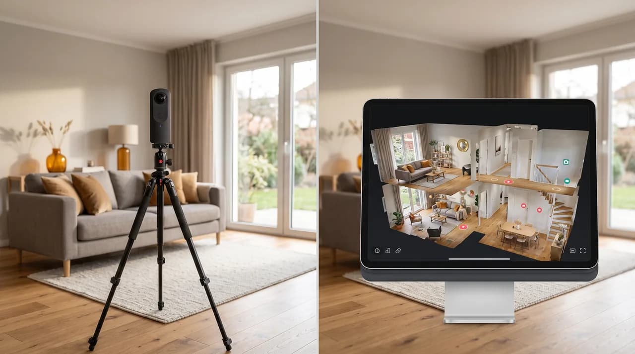
At some point in almost every conversation with a real estate agent, developer, or facility manager, the same question comes up: should the next listing get a classic 360° panorama tour, or a full Matterport-style 3D scan? Both formats let a visitor click through a property from their couch, both show up as a polished link in an exposé, and both are commonly lumped together under the umbrella term "virtual tour." In practice, though, they are built on entirely different technology, they cost different amounts of money and time, and they solve different problems. Treating them as interchangeable is where most of the confusion — and most of the wasted budget — comes from.
This article is not about which format is "better" in the abstract. It's about which format makes more sense for a specific property, a specific audience, and a specific goal. A 45 sqm rental apartment, a 600 sqm logistics hall, and a luxury villa marketed to international buyers all have different requirements, and the honest answer to "360° or Matterport?" is almost always "it depends on what you're trying to achieve." Our job is to help you make that call with a clear picture of what each technology actually does under the hood — not just what the marketing brochures promise.
How a Classic 360° Panorama Tour Works
A classic 360° tour is, at its core, a sequence of individual panoramic photographs stitched together and connected with clickable hotspots. On site, a photographer sets up a tripod with a specialised 360° camera or rotating panoramic head at each key position in the property — typically one shot per room, or one per distinct viewpoint in larger spaces. The camera captures a full spherical image, several exposures blended together, which is then processed into a seamless panorama with no visible stitch lines. This is a mature, well-understood workflow that has been used in real estate marketing for well over a decade.
Once the individual panoramas are edited — corrected for exposure, verticals straightened, tripod removed from the nadir — they are linked together in a viewer. The viewer places small arrow icons or dots directly in the image, and clicking one animates a transition into the next panorama. Additional hotspots can carry information: a pop-up describing a room, a link to a floor plan, an embedded video, or a call-to-action button. The visitor experience is fluid and intuitive, and modern viewers render beautifully on both desktop and mobile, including gyroscope-based looking-around on a phone.
What a classic 360° tour does not contain is any real geometric data. The panoramas are visually convincing, but there is no depth information behind the image — no measurements, no 3D model, no way to generate a floor plan automatically from the capture. If you want a floor plan alongside a 360° tour, it has to be produced separately, usually from existing architectural drawings or a manual on-site measurement. The format is, in the most literal sense, a photographic experience rather than a spatial one. That is not a weakness so much as a design choice: it keeps the technology lightweight, fast to shoot, and inexpensive to produce, at the cost of not being able to answer questions like "how far is it from the window to the opposite wall?"
How Matterport and LiDAR-Based 3D Scanning Works
Matterport and comparable LiDAR- or structured-light-based systems work on a fundamentally different principle. Instead of capturing flat images from fixed points, the scanner captures both color imagery and precise depth data at every position. As the camera is moved through the property — typically on a tripod that is repositioned every few metres — it emits infrared light or laser pulses and measures the time it takes for that light to bounce back from every surface in the room. The result at each scan position is not just a photo, but a point cloud: a dense set of coordinates in three-dimensional space, each one tagged with color information from the visual sensor.
The software then stitches these individual point clouds together into a single, continuous 3D model of the entire property, using overlapping features between adjacent scans to align them automatically. This is what makes the two signature Matterport features possible. The dollhouse view renders the entire building as a doll's-house-style 3D model that the viewer can rotate, tilt, and zoom, cutting away the roof or walls to see how rooms relate to one another spatially — something a classic 360° tour simply cannot produce, because it never captured that spatial relationship in the first place. The auto-generated floor plan is derived directly from the point cloud: the software detects wall planes and openings and produces a 2D schematic floor plan automatically, without a surveyor or CAD operator drawing it by hand.
The measurement tool follows the same logic. Because every point in the model has real-world coordinates, a viewer can click on two points anywhere in the scan — the width of a window, the length of a kitchen counter, the ceiling height — and get an accurate distance reading directly in the browser, no tape measure required. For facility managers doing space planning, for developers verifying as-built dimensions against drawings, or for buyers trying to figure out if their furniture will fit, this is a genuinely different category of usefulness than a photograph, however immersive. The tradeoff is that the process depends on capturing accurate, complete depth data at every position, which places real constraints on how the property must be scanned and how the resulting model can be used.
Shoot Time and On-Site Effort
On a typical residential unit, a classic 360° shoot is fast. A two- or three-bedroom apartment can usually be captured in 30 to 60 minutes once the property is prepared, because the photographer is really just moving a tripod from room to room and firing a handful of exposures at each position. Larger properties scale roughly linearly — more rooms, more positions, more time — but the per-position workload stays light.
A Matterport-style scan takes noticeably longer on site for a comparable property, often 1.5 to 2 times the duration, because the scanner needs more capture positions per room to build a clean, gap-free point cloud, and each position takes slightly longer to process the depth data. Awkward geometry — mirrors, glass surfaces, very dark rooms, or oddly shaped spaces — can slow this down further, since reflective or transparent surfaces confuse depth sensors and sometimes require a second pass. Outdoor areas, balconies in bright sunlight, and reflective water surfaces are also harder for LiDAR-based systems than for a camera doing conventional photography, which is worth knowing if your property has a strong outdoor component.
The gap widens on larger commercial or industrial properties. A warehouse, office floor, or retail space with a complex, multi-room layout can take considerably more scan time than a photographic 360° shoot of the same square footage, purely because of the number of positions needed for clean depth coverage. For a portfolio of many small units, this time difference compounds quickly and becomes a real scheduling and cost factor, not just a technical footnote.
Cost Structure and Economics
The cost difference is not only about the shoot itself — it runs through the entire production chain. Classic 360° tours have a comparatively simple cost structure: photographer time on site, panorama stitching and editing in post-production, and hosting the finished tour, usually on the provider's own infrastructure or a lightweight third-party viewer with no ongoing licence obligation tied to the platform that generated the images.
Matterport-based scans carry an additional layer of cost that is easy to underestimate: platform licensing. Matterport is not just a camera, it is a hosted ecosystem — the models typically live on Matterport's own servers, and continued public access to a scan generally requires an active subscription tied to that specific model, not just a one-time production fee. This means the economics of a Matterport tour are not fully captured in a single invoice; there is a recurring cost dimension baked into the format itself, which matters a great deal if you are scanning a high volume of properties or want tours to stay online indefinitely without ongoing fees. Post-production for a 3D scan also tends to require more processing time, since the point cloud has to be cleaned up, aligned, and rendered into the various view modes before it is publishable.
For a single high-value listing, this cost difference is usually immaterial against the value of the sale. For a facility manager documenting forty units, a franchise network standardising output across fifty branch offices, or an agency running high shoot volume, the gap between a one-time production fee and a per-model recurring licence becomes a meaningful line item that needs to be planned into the budget from the start, not discovered after the fact.
Floor Plan, Measurement Tool, and Dollhouse View: The Real Differentiator
If there is one feature set that actually decides which format to choose, it is this trio: the automatically generated floor plan, the click-to-measure tool, and the dollhouse view. These three capabilities exist only because the underlying capture contains real spatial geometry, and no amount of clever post-production on a classic 360° tour can replicate them, because the raw data simply isn't there.
For certain audiences, this is not a nice-to-have, it is the entire point of commissioning the tour. A facility manager comparing as-built conditions against architectural drawings needs the measurement tool. A relocation buyer trying to work out whether their existing furniture and rugs will fit into a new apartment needs accurate dimensions, not just a beautiful image. A developer marketing a multi-unit building to institutional investors benefits enormously from the dollhouse view, because it communicates the overall layout logic of a building in a way that a sequence of individual room panoramas never quite manages — you see how the rooms actually connect, not just what each one looks like in isolation.
Conversely, for a straightforward rental listing or a cosy owner-occupied apartment aimed at emotionally engaged private buyers, these tools add relatively little marketing value. A prospective tenant deciding whether they like the light in the living room is responding to atmosphere, not floor plan geometry. This is precisely why the choice of format should follow the intended use case rather than a blanket policy of "always use the more advanced technology" or "always use the cheaper option."
The Credibility Factor for B2B and Franchise Clients
Beyond the functional differences, there is a trust dimension that becomes increasingly important the more professional the audience. Institutional buyers, corporate tenants, franchise headquarters standardising output across branch locations, and facility managers reporting to stakeholders tend to read a Matterport-style scan as a signal of technical rigor. The presence of a measurement tool and an auto-generated floor plan implicitly says: this data is accurate, verifiable, and was not just curated for the prettiest angle. In B2B contexts where a decision-maker is comparing several properties without ever visiting any of them in person, that credibility signal can shorten the sales cycle meaningfully.
Franchise networks in particular tend to gravitate toward Matterport or comparable 3D scanning as a house standard, because it produces a consistent, comparable data format across every location, regardless of which photographer captured it or which market it's in. A regional manager reviewing thirty locations wants to click through the same interface every time and trust that the floor plan and measurements behind each one were generated the same way, not hand-drawn to varying standards by different local providers.
Classic 360° tours, meanwhile, retain their own credibility in contexts where the emotional, photographic quality of the presentation matters more than data verification — high-end residential listings, hospitality properties, and boutique developments where the goal is to make someone fall in love with a space rather than audit it. The two formats are, in effect, speaking to two different registers of trust: one built on visual craft, the other on verifiable data.
Typical Use Cases for Each Format
In practice, certain property types and marketing goals map fairly predictably onto one format or the other. Classic 360° tours tend to be the better fit for residential sales and rentals aimed at private buyers or tenants, boutique hospitality properties, show homes intended to sell a lifestyle, and any situation where budget and turnaround time are tight and the priority is a fast, attractive, shareable link.
Matterport-style 3D scans earn their cost in commercial real estate marketing to institutional investors, facility documentation and space planning for corporate real estate teams, construction progress documentation where as-built accuracy matters, insurance and condition documentation, and any franchise or portfolio context where standardised, comparable data across many locations is more valuable than any single tour looking spectacular. Retail and office leasing also benefits disproportionately from the floor plan and measurement tools, since prospective tenants are frequently trying to work out whether their own layout and furniture plan will actually fit.
There is naturally a large middle ground — mid-market apartment buildings, standard office space, mixed residential-commercial properties — where either format can work reasonably well, and the deciding factor often comes down to budget, timeline, and whether the client specifically asked for measurable data.
Combining Both Formats: A Pragmatic Middle Path
It's worth noting that this is not always an either-or decision. For flagship properties or high-value commercial assets, a combined approach is often the most pragmatic solution: a Matterport-style 3D scan to deliver the floor plan, measurement tool, and dollhouse view that serious buyers and facility managers expect, paired with a curated set of classic 360° panoramas — or even standard photography — for the rooms and angles where visual polish matters most for marketing.
This hybrid approach lets each format do what it's good at. The 3D scan handles the functional, data-driven side of the presentation, while the photographic layer handles the emotional, aspirational side that actually gets clicks and inquiries. It costs more than either format alone, but for a property where both dimensions genuinely matter — a large executive residence marketed internationally, for instance, or a mixed-use development pitched to both investors and future tenants — the combined package frequently outperforms either format used in isolation, and clients increasingly ask for it once they understand the tradeoffs.
Conclusion
Neither format is objectively superior — they are built for different jobs. A classic 360° panorama tour is fast to shoot, inexpensive to produce, free of ongoing licensing costs, and excellent at creating an emotionally engaging, photographic walkthrough. A Matterport-style 3D scan takes longer on site, costs more overall once hosting and licensing are factored in, but delivers a floor plan, measurement tool, and dollhouse view that no amount of photographic skill can replicate, and it tends to carry more credibility with institutional and franchise audiences who are evaluating a property remotely.
The practical question isn't which technology is more advanced — it's which one actually serves your audience and your goal for this specific property. A private buyer falling in love with a renovated apartment and a facility manager auditing forty branch locations against architectural drawings need fundamentally different tools, even though both might casually be described as wanting "a virtual tour." If you're not sure which fits your situation, talk to us before the shoot is booked — matching the format to the goal at the outset saves both budget and rework, and in cases where both dimensions matter, a combined approach is often the smartest way forward.