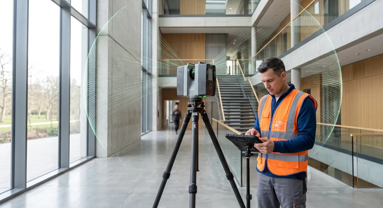
Walk into a modern architecture office, a facility management team, or a premium real-estate agency, and you will increasingly hear the same phrase: "Let's just scan it." Behind that casual sentence sits a surprisingly sophisticated technology stack that can capture an entire building, inside and out, as a cloud of millions of precise measurement points, and turn that raw data into floor plans, 3D models, and even fully structured digital twins.
But how does 3D building surveying actually work? What is happening when a technician sets up a tripod-mounted scanner in the corner of a room, or walks through a hallway holding a device that looks like a futuristic vacuum cleaner? And when do you actually need this level of precision, rather than a simple photo tour?
This guide explains the whole process from first principles, in plain language. We follow a project from the physics of the sensors, through scan planning and data processing, to the finished deliverables and the accuracy you can realistically expect, so you understand not just what 3D surveying is, but whether it is the right tool for your situation.
What "3D Building Surveying" Actually Means
At its core, 3D building surveying is the process of measuring the real, physical geometry of a structure and recording it as accurate digital data. Instead of a person pulling a tape measure across a room and writing down a handful of numbers, a scanner records the position of millions or even billions of individual points on every surface it can see. Each point has an X, Y, and Z coordinate in three-dimensional space, and together they form a point cloud, a dense digital replica of the building.
The important word here is measured. A photograph shows you what a wall looks like, but it does not tell you how long the wall is, how far apart two door frames sit, or whether a ceiling slopes. A 3D survey does exactly that: every surface in the resulting dataset carries real dimensions, so you can measure the distance between any two points long after the scanning team has left the site. This is the fundamental difference between capturing an appearance and capturing geometry.
The technique borrows from traditional land surveying, architectural documentation, and the computer-vision methods used in robotics and self-driving cars. What makes the modern version so powerful is speed and density: a task that once took two people several days with a tape measure can now be done in a few hours, with a result that is far richer and less prone to human error. That is why it has spread so quickly from specialist engineering firms into everyday property work.
The Sensors Behind the Scan: LiDAR vs Structured Light
Everything in 3D surveying begins with the sensor, the component that measures distance. There are two dominant families of technology, and the difference between them explains most of the trade-offs you will encounter.
The first and most common is LiDAR, which stands for Light Detection and Ranging, and works on the time-of-flight principle. It fires a rapid stream of harmless laser pulses into the room and measures the tiny amount of time each pulse takes to bounce off a surface and return; because the speed of light is a known constant, that travel time converts into a precise distance. The laser sweeps across the whole scene, spinning and tilting to cover every direction, taking hundreds of thousands of measurements every second, each becoming one point in the cloud. Time-of-flight LiDAR is prized because it works over long ranges, performs well in large or dimly lit spaces, and is largely unaffected by the color or texture of surfaces.
The second family is structured light, sometimes combined with a related method called photogrammetry. Instead of timing a laser bounce, a structured-light sensor projects a known pattern, often an invisible infrared grid, onto surfaces and uses a camera to observe how that pattern deforms as it wraps over objects; the distortion reveals the shape and depth of everything in view. This captures very fine surface detail at close range with beautifully textured, realistic results, which is why many popular indoor scanning cameras rely on it. Its weaknesses mirror LiDAR's strengths: structured light struggles with long distances, with bright sunlight that washes out the projected pattern, and with shiny or transparent surfaces like glass and polished metal.
In practice, many modern devices blend both worlds, using time-of-flight ranging for accurate geometry while capturing high-resolution photographs that are draped over the model for a lifelike appearance. The right sensor depends on the size of the space, the detail required, the lighting, and how quickly the survey must be completed, and a good surveying partner selects the technology to fit the building, not the other way around.
Planning a Scan: Coverage, Positions and Overlap
It is tempting to think of scanning as simply pressing a button, but the quality of a survey is largely decided before a single measurement is taken. Scan planning is the discipline of deciding where the scanner will sit, or which path it will travel, so that every surface is captured with no gaps and enough overlap.
The central challenge is line of sight: a scanner can only measure what it can see. Anything hidden behind a column, tucked inside an alcove, or blocked by furniture becomes a shadow, an empty region in the point cloud where no data exists. To eliminate these shadows, a technician plans multiple scan positions, or scan stations, so that areas hidden from one vantage point are visible from another. In a complex building this might mean dozens or even hundreds of setups, each contributing its own overlapping slice. Stairwells, tight bathrooms, and cluttered basements demand the most positions because they contain the most obstructions.
Overlap is the second planning principle, and it matters for a reason we will return to shortly. When two neighboring scans share a generous portion of common area, the software has plenty of matching features to lock them together accurately later; skimp on overlap and the scans may drift apart or fail to align at all. Good planning is invisible in the final result because it prevents problems from ever appearing; poor planning shows up as holes, misalignments, and costly return visits to the site.
From Raw Measurements to a Point Cloud
Once the scanning is complete, the project moves from the physical site to the computer, and the first product to emerge is the point cloud itself. Each scan station has produced its own local cloud of points, measured relative to the scanner's position, so individually these are just isolated snapshots until the raw sensor readings are converted into clean, usable coordinate data.
A single point cloud from a modern scanner can contain hundreds of millions of points, and a whole building can run into the billions. Every point stores its position in space and usually additional information: an intensity value recording how strongly the laser reflected, and often an RGB color value sampled from onboard cameras. Viewed on screen, you can fly through the building as though it were a photograph you can walk around inside, except that every surface is made of real measured points rather than pixels.
Before the data is truly usable, it goes through cleaning and processing. Scanners inevitably capture noise, stray points floating in mid-air caused by dust, moving people, reflections, or the edges of glass. Processing software filters out this noise and thins overly dense regions to keep file sizes manageable. The result is a tidy, trustworthy point cloud, the raw material from which every subsequent deliverable is derived.
Registration: Stitching Scans into One Coherent Model
We now reach the step most non-specialists have never heard of but which is arguably the heart of the process: registration. Because a building was captured from many separate scan positions, each with its own local frame of reference, those individual clouds must be aligned and merged into a single, seamless whole. Registration is the mathematical process of finding exactly how each scan fits together with its neighbors, like assembling a three-dimensional jigsaw where every piece must line up to within millimeters.
This is where the overlap planned earlier pays off. The software looks for common features and shared surfaces that appear in two or more scans, then rotates and shifts each cloud until those overlapping regions match as closely as possible. Some workflows use physical reference targets like marked spheres or checkerboard plates as unambiguous anchor points; others rely purely on the geometry of the environment. Either way, the goal is a globally consistent model in which a wall measured from three positions appears as one crisp surface rather than three offset ghosts.
The quality of registration determines the accuracy of the entire survey. If scans are stitched together loosely, small alignment errors accumulate across a large building and grow into significant distortions by the far end of the structure. This is why professional providers watch registration error, a figure describing how tightly the scans agree; a well-registered project might hold its alignment to just a few millimeters across an entire floor. Once registration is complete, the many separate scans have become one unified point cloud, correctly proportioned and ready to become whatever deliverable the client needs.
Output Products: Point Cloud, Mesh, Floor Plan, BIM Model
A registered point cloud is enormously valuable, but it is rarely the final destination. Most clients want something more immediately usable, and this is where the survey branches into several distinct output products, each suited to a purpose. The point cloud itself is the first deliverable, and for engineers and specialists it is often enough: the most complete and objective record possible, a raw measurement of reality that can be re-measured for years. The second product is the mesh, or surface model, where the software connects the points into a continuous skin of tiny triangles, producing a solid-looking 3D surface. Draped with photographic texture, a mesh becomes the smooth, navigable 3D model people recognize from immersive virtual tours, ideal for visualization and communication.
Two more deliverables translate the 3D data back into forms the construction world has always used. The floor plan is a precise two-dimensional drawing generated by slicing the point cloud horizontally at a standard height and tracing the walls, doors, and windows; because it is derived from real measurements, it reflects the building exactly as it was built, capturing every wall thickness and irregularity that old drawings often miss. The most advanced deliverable is the BIM model, short for Building Information Modeling. Rather than a passive drawing, it is an intelligent, structured database in which each element, a specific wall, a door, a length of ductwork, is a distinct object carrying properties like material, dimensions, and function. Feeding an accurate as-built survey into BIM gives architects and facility managers a living digital twin they can plan renovations against, run simulations on, and maintain across the whole life of the building.
How Accurate Is It? Accuracy Levels by Use Case
Accuracy is the question everyone eventually asks, and the honest answer is that it depends on what you are trying to achieve. 3D surveying delivers a spectrum of precision, from broadly indicative down to sub-millimeter, and matching the right level to the job keeps a project both reliable and cost-effective, since chasing more accuracy than you need simply wastes time and money.
At the highest end sit engineering and structural applications, where deviations must be held to a few millimeters or even fractions of a millimeter. Surveying a factory to fit new machinery, documenting a heritage facade, or checking whether a structure has shifted over time all demand this top tier and justify the slower, more meticulous workflows required to reach it. A middle tier, accurate to within a centimeter or so, serves the vast majority of architectural and renovation work: when an architect needs reliable as-built plans to design an extension or reconfigure interior walls, centimeter accuracy comfortably outperforms manual measurement.
For property marketing and space documentation, the tolerances relax further. A virtual tour or a marketing floor plan needs to be dimensionally believable and useful for calculating areas, but it does not need engineering precision, so accuracy in the range of a few centimeters is acceptable and the priority shifts toward visual quality and speed. The key point is that accuracy is a deliberate choice, not a fixed property of the technology: a trustworthy provider asks what the data is for, then selects the equipment, scan density, and processing effort that meet that requirement without overspending on precision no one will use.
3D Surveying vs Photo-Based Virtual Tours
Because both can produce an immersive walkthrough on screen, 3D surveying and simple photo-based tours are often confused, yet they are fundamentally different. A photo-based tour, such as a series of connected 360-degree panoramas, is essentially a collection of clever photographs: you can look around from fixed points and jump between them, which is engaging and inexpensive, but the underlying data is imagery, not measurement. You cannot reliably pull a dimension from it, because the software never measured the space; it only photographed it.
A true 3D survey, by contrast, is built on measured geometry. Even when the end product looks like a comparable virtual tour, every surface behind it carries real coordinates. That means you can measure a doorway, calculate a floor area, extract an accurate plan, or feed the data into design software, none of which a pure photo tour can support. The distinction is between something that shows you a space and something that quantifies it.
The practical consequence is cost and effort. Photo-based tours are fast and cheap, excellent for marketing a home or giving a quick remote impression of a venue. Measured surveys require more expensive sensors, careful planning, and significant processing, so they cost more and take longer, but they unlock everything downstream that depends on real dimensions. Choosing between them comes down to one question: do you need to look at the space, or to work with its measurements?
Who Needs 3D Surveying, and Who Is Better Served by a Simple Photo Tour
With the technology and trade-offs understood, the decision becomes practical. Some projects genuinely require measured 3D data, while others are better served by a straightforward photo or video approach, and knowing which camp you fall into prevents both under-buying and over-buying. You need real 3D surveying whenever the geometry itself will be used for work. Architects rely on it for accurate as-built documentation before designing renovations, because starting from outdated or missing drawings invites expensive on-site surprises. Facility managers use it to build digital twins of large buildings for maintenance and space planning. Developers and premium agents turn to it when area calculations must be legally defensible, since a measured survey produces figures that stand up to scrutiny far better than a tape measure and an old plan. And construction and engineering teams need it wherever collisions, tolerances, or structural change must be controlled to the centimeter or better.
A simpler photo or video approach is the smarter choice when the goal is presentation rather than measurement. Marketing a family home, showcasing a holiday rental, or producing an attractive walkthrough for social media are all served beautifully by 360-degree tours or professional video, at a fraction of the cost of a full survey. The guiding principle throughout is fit for purpose: the most advanced technology is not a badge of quality if it answers a question no one was asking.
Conclusion
3D building surveying can look like magic from the outside, but seen up close it is a logical chain of well-understood steps: a sensor that measures distance from the timed bounce of a laser or the distortion of projected light, a planned set of scan positions that leave no surface unseen, a dense point cloud cleaned of noise, a registration process that stitches every scan into one model, and finally a choice of deliverables, from raw cloud to mesh, floor plan, or intelligent BIM twin, each tuned to the accuracy the project requires.
The single most useful idea to carry away is that measurement and appearance are not the same thing. A photo shows you a room; a survey lets you work with it. That difference separates a marketing tour from an engineering document, and it is the question every property owner, planner, or manager should ask before commissioning either. Understand what you need the data to do, and the right method almost chooses itself. When the answer calls for genuine measured geometry, professional 3D surveying delivers a reliable, reusable foundation of truth about your building, long after the scanner is packed away.