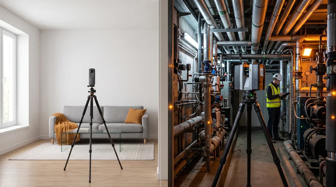
At first glance, a 3D walkthrough scan looks like the answer to almost every requirement around the digital capture of buildings. You enter a room, set up the device, and a few hours later there is a walkable, photorealistic twin of the property. For sales, letting, documentation and communication, that is often exactly the right tool. But there is a point at which the beautiful virtual tour reaches its technical and legal limits and survey-grade laser scanning becomes necessary.
As a provider that has both methods in its portfolio, we would rather tell you honestly up front which method fits when, than explain to you after the fact why a dataset turned out to be unusable for your construction project. This article shows you where the strengths of a 3D walkthrough scan lie, where it becomes too imprecise or too incomplete by design, and how the two worlds can be combined sensibly.
One idea runs through the entire text: calling a method unsuitable is not a criticism of the method itself, but a question of purpose. A 3D walkthrough scan is not worse than laser scanning; it is built for a different task. Anyone who cleanly separates the two makes better decisions, avoids spending money on the wrong kind of capture, and ends up with exactly the data quality that the respective trade actually needs.
What a 3D Walkthrough Scan Really Is and What It Is Not
A 3D walkthrough system combines panoramic photography with depth capture via infrared or LiDAR and assembles a coherent virtual tour from many vantage points. The result is what is known as a digital twin: a visually convincing, walkable model with floor plan views, measurement functions and pleasant browser-based navigation. The software automatically links the individual shots and computes an overall spatial image from them.
How this linking comes about is decisive. The system registers the individual vantage points via visual features and depth information, not via a geodetically secured measurement chain. Small deviations at each vantage point add up over larger distances. Within a single room the error stays small; across an entire floor or several storeys it can grow noticeably. This is not a malfunction but is rooted in the design of the system, which is optimised for vividness and speed.
That is why it makes sense to understand the 3D walkthrough scan as a communication tool rather than a surveying instrument. The built-in measurement function delivers usable approximate values for a rough overview, for example whether a couch will fit through a door or roughly how high a room is. But as soon as measurements with legal or structural bearing are required, you leave the realm the method was designed for.
This is exactly where most misunderstandings arise in practice. Because the result looks so professional and exact, it is credited with a precision it never claims to have. The photorealistic impression tempts people to take displayed centimetre values at face value. It is therefore worthwhile, already at the quotation stage, to state clearly what purpose a scan is meant to serve, so that everyone involved classifies the results correctly and no one later works on with false expectations.
The Question of Accuracy: Tolerances in Construction
In construction, accuracy is not thought of as a feeling but in concrete tolerances. Codes and standards define which deviations are permissible for dimensions in building construction, and these tolerances often lie, depending on the component and its length, in the range of a few millimetres to centimetres. Anyone having a window front manufactured on the basis of a digital measurement, or planning a drywall partition that has to fit exactly into an existing opening, cannot afford unclear deviations.
A 3D walkthrough scan usually does not provide a secured, traceable accuracy figure for each measured point. You see a dimension, but not the associated margin of error. For furnishing a room, that is uncritical. For a custom fabrication, a made-to-measure kitchen, a steel staircase or a facade element that has to be fitted on site, this very lack of traceability is the problem. If the fabricated component ends up not fitting, it helps no one that the virtual tour looked nice.
Survey-grade laser scanning, by contrast, works with a defined point accuracy that typically lies in the millimetre range and documents it traceably. The devices are calibrated, the individual vantage points are registered under control via control points or a network of target markers, and the registration quality can be checked and proven. Only this approach delivers the reliability that a fabrication or a construction planning process needs. The difference is not gradual but fundamental: one method estimates vividly, the other measures dependably.
On top of that, in professional laser scanning the accuracy relates not just to the individual point but to the entire object. Because the vantage points are brought together via a controlled network, dimensional fidelity is preserved even over large distances and across many rooms. It is precisely this aspect of global consistency that distinguishes a dependable foundation from a pretty virtual tour, and in many construction projects it decides whether later components fit without rework.
CAD and BIM: Why a Point Cloud Is the Foundation
As soon as a planning model is to be created from the capture, the requirement changes completely. For CAD planning, and even more so for BIM models, architects, specialist planners and structural engineers need a geometrically correct foundation from which walls, openings, heights and connections can be derived to scale. This foundation is the point cloud, that is, a dense set of individually surveyed 3D points that represents the real geometry of the building.
A 3D walkthrough scan does provide depth data and, in some configurations, an exportable point cloud, but its density and accuracy are usually not sufficient for professional planning processes. Edges become blurred, fine profiles smear, and the overall geometry is not secured to a coordinate system. A planner who builds an as-built model from such data unknowingly carries the inaccuracies into the model and thus into all downstream trades.
A survey-grade point cloud from terrestrial laser scanning, by contrast, is dense, edge-sharp and referenced. From it, an as-built model with defined level of detail and accuracy can be built, serving as a reliable basis for tendering, clash detection and detailed design. Particularly in building within existing structures, where there are no plans or only outdated ones, this clean starting point is the decisive factor for a smooth project. Errors avoided here cost no money later on the building site.
Complex Geometry, Plant Equipment and Hard-to-Reach Areas
3D walkthrough systems are designed for clearly structured, easily walkable interiors. In apartments, offices, exhibition spaces and simple commercial units, they play to their strengths. As soon as the geometry becomes complex, the picture changes. Angular industrial halls, densely packed plant rooms, pipework systems, structural steelwork, machinery and equipment with many occlusions push a system to its limits when it needs a clean visual transition from vantage point to vantage point.
Where pipes overlap, where narrow niches, shafts, platforms or intermediate levels have to be captured, gaps and distortions arise in the 3D walkthrough model. Reflective surfaces, glass, shiny metal and poorly lit areas make the problem worse still, because both the photography and the depth capture react sensitively to them. The result can look vivid and yet be unusable at the decisive points.
Professional laser scanners are built for exactly these scenarios. They capture even complex plant geometry with high point density, can be positioned flexibly and brought together under control across many vantage points. For industry, plant engineering and building services, this is often the only way to document the existing structure completely and to scale. When it comes to integrating a new installation into a cramped existing structure, the completeness and accuracy of this capture decides the success of the planning.
In such environments the value of point density becomes especially clear. The finer the mesh of measurement points, the more reliably even slender pipes, brackets, cable trays and small attachments can later be reconstructed in the model. Where a walkthrough system delivers only a rough surface, a dense point cloud allows clash detection in detail before a single screw is ordered. Particularly in operating facilities, where every conversion measure happens under time pressure and within tight shutdown windows, this planning certainty up front is worth hard cash.
Facade and Exterior: Where the Virtual Tour Ends
Another clear break shows as soon as you go outside. 3D walkthrough systems are optimised for interiors with controlled lighting conditions. Outdoors, direct sunlight, changing light, large distances and wide open areas change the conditions so much that the depth capture loses considerable reliability. Facades spanning several storeys, roof surfaces, courtyards and terrain situations cannot be captured this way in the quality that planning requires.
Facade work in particular places high demands on measurement. Thermal insulation, ventilated curtain-wall facades, window replacement in existing structures or the heritage-appropriate restoration of a historic elevation demand a to-scale, complete depiction of the entire building envelope, including all projections and recesses, cornices and openings. Such tasks lie beyond what a walkthrough system can and should deliver.
This is where terrestrial laser scanning and, in support, photogrammetric methods come into play, partly combined with drone-based capture for roofs and high facade areas. These methods deliver a referenced, dense point cloud outdoors too, from which elevations, sections and facade plans can be derived to scale. Anyone who wants to work on the building envelope needs this data basis, regardless of how good the interior already is as a walkthrough tour.
Another point concerns the connection between inside and outside. Restorations frequently affect the entire building envelope, and interior and exterior measurements have to match one another so that, for example, window connections, reveals and insulation thicknesses can be planned coherently. An isolated interior tour and a separately captured exterior dimension without a common reference lead to breaks at precisely the points where fit accuracy matters. A consistently referenced capture links both sides in a common coordinate system and makes these transitions plannable.
Legally Reliable Floor Area Figures and Dependable Documentation
Floor area figures are rarely just a technical quantity; they often have immediate economic and legal consequences. Rental areas, sales areas, living areas and usable areas determine purchase prices, rents, service charge statements and operating cost apportionments. Defined codes and calculation rules apply to determining them, and in the event of a dispute the stated area has to be traceable and defensible.
The areas derived from a 3D walkthrough floor plan are useful for initial orientation but are not intended as a legally reliable basis. What is missing is the traceable measurement chain, the documented accuracy and, often, the unambiguous allocation of areas according to the applicable code. Anyone who writes an area figure into a lease or purchase contract on this basis takes an avoidable risk that can later prove expensive.
A clean measurement based on survey-grade data, by contrast, delivers dependable areas that can be allocated to a code and, if in doubt, proven. For transactions, for the designation of rental areas in larger properties, or for binding as-built documentation, this is the standard you can rely on. Here too it holds: the 3D walkthrough scan can support communication and presentation excellently, but the binding figure comes from surveying.
The Decision: When the Tour Is Enough, When You Need the Point Cloud
The good news is that the decision can usually be made clearly if you ask the right question. It is not which method is technically more impressive, but what is to happen with the data. A 3D walkthrough scan is the right choice when it comes to presentation, marketing, letting, remote viewing, general documentation of the current state or vivid communication between the parties involved. In these cases the virtual tour is not only sufficient but often the superior solution, because it is fast, inexpensive and intuitively understandable.
But as soon as things are fabricated, planned, built or calculated from the data, the requirement shifts clearly towards survey-grade capture. Concretely, this applies to CAD and BIM as-built models, to fabrication measurements and custom fabrications, to facade and exterior work, to complex plant and industrial buildings, and to legally reliable floor areas and binding documentation. Whenever a dimension has a consequence that touches money or liability, it needs the demonstrable accuracy of a point cloud.
In practice, a simple test helps: ask yourself whether someone will order, fabricate or sign something on the basis of the stated dimension. If so, there is hardly any way around a survey-grade capture. If, on the other hand, it is about showing, explaining and presenting, the 3D walkthrough scan is usually the more efficient answer. Making this distinction up front saves considerable effort over the course of the project and prevents duplicate capture.
Combining Both Methods: The Pragmatic Path
In many projects the answer is not either-or but both. One and the same building can be prepared for marketing as a walkable 3D walkthrough tour and, at the same time, captured for planning as a survey-grade point cloud. Both datasets serve different recipients and purposes but complement each other excellently. Sales works with the vivid tour, planning with the to-scale data.
The pragmatic approach consists of aligning the level of detail and accuracy per area with the actual need. It is not always necessary to capture the entire object at the highest surveying quality. Often it is enough to scan individual planning-relevant areas at survey grade and document the rest as a virtual tour. That keeps the effort within bounds without losing accuracy at the decisive points. This graduated capture is often the most economical solution.
Because we at FotoEstate offer and master both methods, we can plan this division sensibly from the outset. At the beginning we clarify with you which results you need, what accuracy the individual trades require and which data formats are to be processed further. From that follows where the fast virtual tour is enough and where the point cloud is indispensable. The aim is not to sell you the most expensive method but the right one, so that in the end the data does exactly what you need it for.
Conclusion
A 3D walkthrough scan is an excellent tool, but not a surveying instrument. Its strengths lie in vividness, speed and communication; its limits show wherever binding dimensions, complex geometry, facades, legally reliable floor areas or CAD and BIM models are required. The decisive question is not which method is the better one, but what is to happen with the data. If it is shown and presented, the tour is enough. If it is fabricated, planned and built, it needs the survey-grade point cloud.
The most honest and at the same time most economical recommendation is usually the combination of both worlds, graduated according to actual need. Anyone who makes this decision early and with the right partner avoids unusable datasets, duplicate captures and expensive surprises on the building site. Talk to us before you have anything scanned, and we will clarify together which method, or which combination, your project really needs.