Most conversations about facility digitization start in the wrong place. A service provider is offered a 3D scan of a building, a colourful point cloud appears on screen, everyone nods approvingly, and the project is quietly declared complete. Six months later the same scan sits untouched on a server while the maintenance team still walks the corridors with a clipboard and a torch, hunting for a shut-off valve that nobody can locate on paper.
The problem is not the scan. The problem is treating the scan as the finish line. For facility managers and FM service providers, a digital capture of a building is raw material, not a result. It becomes valuable only when it is enriched, connected to your existing systems, and woven into the daily routines your teams already run. This article walks through what that transition actually looks like, where it delivers measurable savings, and where realistic expectations matter so you do not over-promise to your own stakeholders.
Why a Scan Is the Start, Not the Goal
A modern building scan produces geometry: millions of measured points, panoramic imagery, and often a navigable digital twin you can walk through from a browser. That is genuinely useful. You can measure a corridor without visiting it, check a ceiling height, or show a colleague exactly what a plant room looks like. But geometry on its own is dumb. The scan knows there is a grey box on the wall in room B-014. It does not know that the box is a fire damper actuator, when it was last serviced, who the responsible contractor is, or that it shares a circuit with three others on the same floor.
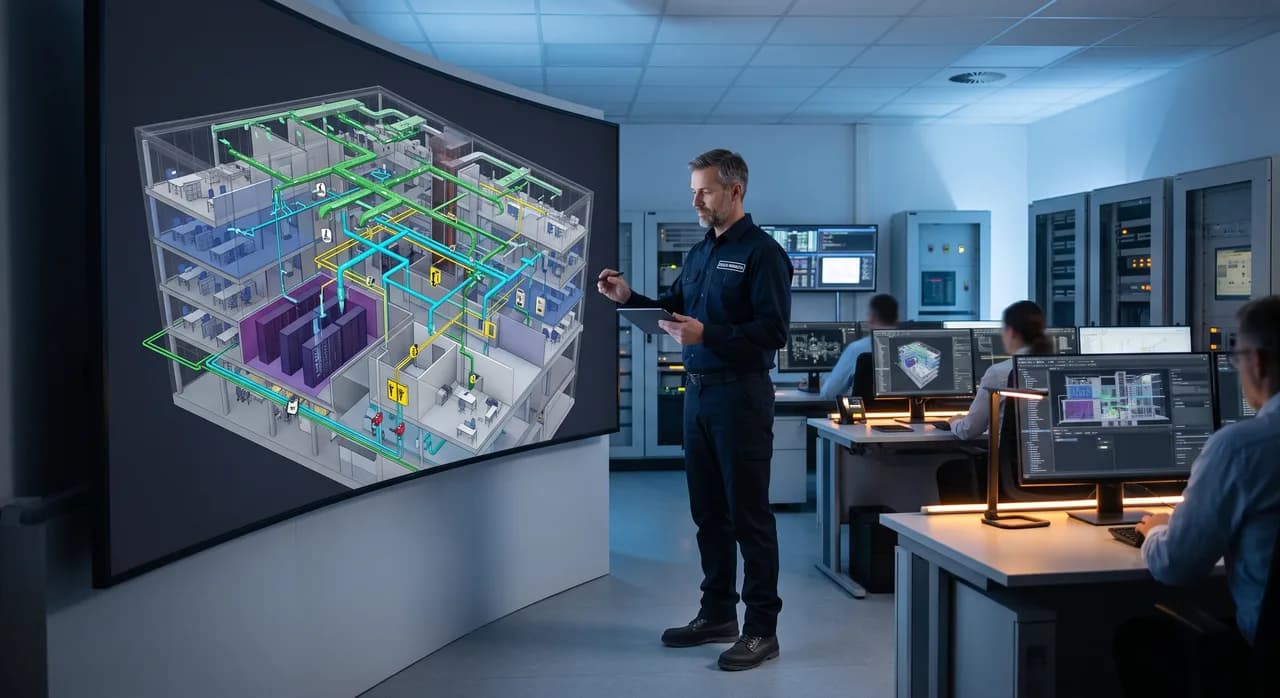
The step that turns a passive model into a working tool is semantic enrichment. This means attaching meaning to what the scan captured. Each relevant object gets tagged: this is an air handling unit, that is a main water shut-off, this panel is the sub-distribution board for the east wing. Those tags carry attributes such as manufacturer, model, installation date, maintenance interval, and links to manuals or warranty documents. Suddenly the model is not a photograph of a building; it is a queryable inventory positioned in real space.
This distinction changes how you scope a digitization project. If you commission only geometry, you receive a pretty viewer and little operational value. If you plan for enrichment from the outset, you decide in advance which asset classes matter, what attributes you need to record, and how the data will feed the systems your team actually uses. The scan cost is a fraction of the total value; the enrichment discipline is where the return lives. Facility managers who understand this negotiate very different projects than those who buy a scan and hope for the best.
Locating Technical Assets and Shut-Off Valves Without a Site Visit
Ask any experienced facilities technician about the worst part of an emergency call-out, and finding the shut-off will feature high on the list. A pipe bursts on a Friday evening in a building the on-call engineer has never entered. Somewhere there is a main stopcock. It might be behind an access panel in a plant room, above a suspended ceiling, or in a riser cupboard three floors away. Every minute spent searching is a minute of water damage accumulating.
An enriched digital twin removes that search. Because every valve, isolator, and shut-off has been tagged and positioned in the model, the engineer opens the building on a tablet, filters for water shut-offs, and sees exactly where they sit before leaving the depot. The panorama shows the surrounding context so the valve is recognisable on arrival rather than one of a dozen similar handles. What used to be a stressful scramble becomes a briefed, deliberate response.
The same principle scales beyond emergencies. Planned work, condition surveys, and compliance checks all depend on knowing where things are. A technician preparing to service twelve fan coil units can plan a walking route through the building in advance, grouping tasks by floor and zone rather than criss-crossing corridors. For FM service providers managing dozens of sites, this location intelligence is the difference between dispatching a generalist who wastes an hour orienting themselves and dispatching one who arrives already knowing the layout. The remote availability of this knowledge is precisely what makes multi-site portfolios manageable with lean teams.
Remote Briefing of Contractors and Tradespeople
A large share of facility management time is spent explaining buildings to people who have never seen them. A contractor quotes for replacing lighting in a warehouse and needs to understand the space, the mounting heights, and the access constraints. A specialist tradesperson is asked to price a repair in a plant room. Traditionally this means arranging a site visit, coordinating diaries, unlocking doors, and accompanying the visitor around the building, a process that can burn a full day before any work is even agreed.
With a digital twin, most of that disappears. You send a link. The contractor walks the space virtually, takes their own measurements from the model, counts fixtures, checks clearances, and prepares a quote without setting foot on site. For competitive tendering this is transformative: you can invite five contractors to quote on the same digital walkthrough, and each of them can assess the job thoroughly in an afternoon. The quality of the quotes improves because everyone is working from the same accurate representation rather than a vague verbal brief.
There is a coordination benefit that runs deeper than convenience. When you brief remotely from a shared model, everyone is looking at the same thing. Misunderstandings about which room, which unit, or which wall shrink dramatically because you can drop a marker directly in the space and say "this one, here." For FM service providers juggling many subcontractors, this shared reference point reduces disputes, abortive visits, and the classic problem of a tradesperson arriving to find the job is not at all what they were told. Site visits do not vanish entirely, but they become the exception reserved for work that genuinely requires physical inspection, rather than the default for every enquiry.
Documenting Concealed Installations Before Walls Close
One of the most expensive blind spots in building operation is everything you cannot see. Pipes run inside walls, cabling threads above ceilings, and ductwork snakes through voids that get sealed and never reopened until something fails. When a technician needs to know whether a wall is safe to drill, or where a leaking pipe actually runs, they are often guessing based on outdated drawings that may or may not reflect what was built.
Capturing installations before they are concealed solves this at its source. During construction, refurbishment, or fit-out, a scan taken at the point when services are installed but before the walls, screed, or ceilings close creates a permanent record of exactly what lies behind the finished surface. This is the moment that never comes again. Once the plasterboard goes up, that information is gone unless it was captured. A twenty-minute scan at the right stage preserves the routing of every visible pipe and cable run for the entire life of the building.
For facility managers inheriting a building, this changes risk management fundamentally. Instead of drilling blind and hoping, a technician consults the concealed-services record and knows what is behind the wall. Instead of exploratory demolition to trace a fault, they narrow the problem before opening anything up. The value compounds over decades: every future modification, every fault diagnosis, and every safety assessment draws on a record that would otherwise have been impossible to reconstruct. Where you control the timing, insisting on a pre-closure scan is one of the highest-return decisions in the whole digitization process, because the alternative is not a worse record but no record at all.
Space and Area Management for Cost Allocation
Buildings cost money by the square metre, and that money has to be allocated fairly. In multi-tenant offices, shared business parks, and mixed-use developments, service charges, rent apportionment, and internal cost centres all depend on accurate area figures. Yet in practice these numbers are frequently wrong, based on old drawings, rough estimates, or measurements taken before the last partition was moved. A discrepancy of a few percent across a large portfolio translates into significant sums recovered incorrectly or not at all.
An accurate scan produces reliable area data because it measures the building as it actually stands, not as it was once drawn. Floor areas, zone boundaries, and usable versus common space can be derived directly from the captured geometry to a recognised measurement standard. When a tenant queries their service charge, you have a defensible basis rather than an inherited spreadsheet nobody can trace. When space is reallocated, the areas update from reality rather than from assumptions.
Space management is also about utilisation, not just billing. Knowing precisely how much area each function occupies lets facility managers benchmark efficiency, identify underused zones, and plan reconfigurations with confidence. A department claiming it needs more space can be assessed against actual occupied area. A proposed move can be modelled against real dimensions before any furniture is ordered. For organisations under pressure to reduce their property footprint, this grounding in accurate area data turns space planning from a negotiation of opinions into a discussion of facts, which is a far healthier basis for decisions that carry six-figure consequences.
Cleaning and Maintenance Planning Based on Accurate Areas
Cleaning contracts are priced on area, and maintenance regimes are scoped on asset counts and access. When both are based on accurate captured data, the whole planning exercise becomes tighter and less adversarial. A cleaning provider quoting on precise floor areas, broken down by surface type and traffic level, produces a quote you can actually compare against others and hold them to. There is no room for the familiar dispute where the contractor claims the areas were understated and demands a variation three months into the contract.
Maintenance planning benefits in a parallel way. When every serviceable asset is inventoried and located, you can build a planned preventive maintenance schedule that reflects what the building genuinely contains rather than a generic template. You know how many air handling units, how many fire dampers, how many emergency lights, and where each one sits. Frequency, labour hours, and access requirements can all be estimated from real data. This makes budgeting more accurate and reduces the reactive firefighting that consumes FM teams working from incomplete records.
Accurate spatial data also improves the logistics of the work itself. Route planning for cleaning rounds, staging of equipment, and sequencing of maintenance tasks all draw on knowing the layout precisely. A provider can calculate realistic productivity rates because they know the true dimensions and the true obstacles. Over a contract lifetime, this precision reduces both the padding that contractors add to cover uncertainty and the shortfalls that occur when a job was underscoped. Everyone benefits from planning against reality: the client pays a fair price, and the provider is not squeezed by figures that never matched the building.
Onboarding New FM Staff and Retaining Knowledge
Facility management runs on institutional knowledge that lives in people's heads, and those heads eventually leave. The long-serving building manager who knows which radiator always airlocks, where the awkward isolator hides, and why the third-floor thermostat reads two degrees high represents years of accumulated understanding. When that person retires or resigns, much of it walks out the door. Their replacement starts from near zero, rediscovering the building's quirks the hard way, often through the same failures the predecessor had already learned to prevent.
A digital twin, enriched with asset data and operational notes, acts as a repository for this knowledge. When the experienced manager tags an asset with a note about its behaviour, or records the location of something non-obvious, that insight is captured in a form the next person can inherit. Onboarding a new team member becomes a guided tour of the model rather than a months-long process of learning by walking into problems. They can explore the building remotely, familiarise themselves with the plant, and understand the layout before they have physically visited every corner.
For FM service providers, this knowledge retention is a competitive strength as much as an operational one. Staff turnover is a fact of the industry, and the ability to bring a new technician up to speed quickly determines how resilient your service is. A portfolio documented as digital twins is far less dependent on any single individual. Continuity survives resignations, holidays, and reassignments because the building explains itself. This does not replace experience, but it dramatically shortens the gap between a new hire's first day and their first competent, unsupervised response, which is exactly where service quality is usually most fragile.
Integrating Scan Data Into CAFM Systems
Most professional FM operations already run a Computer-Aided Facility Management system: the database of assets, work orders, maintenance schedules, and compliance records that drives daily operations. Scan data delivers its full value only when it connects to this system rather than sitting alongside it in a separate viewer. Integration is what turns the digital twin from an interesting visual into an operational layer of the tools your team uses every day.
The connection works in both directions. Assets identified and positioned during enrichment can populate or verify the CAFM asset register, correcting the inaccuracies that accumulate in every database over time. Equipment that exists in the building but was never recorded gets added; entries for equipment long since removed get retired. In return, the CAFM system's live data, service history, open work orders, and warranty status can be surfaced against the spatial model, so a technician clicking an asset in the twin sees its current maintenance state. Location intelligence meets operational data, and each makes the other more useful.
Achieving this requires planning at the start, not the end. The identifiers used to tag assets in the scan need to align with the asset numbering in the CAFM system, or a mapping between them has to be established. The attribute fields captured during enrichment should match what the database expects. This is unglamorous work, but it is where digitization projects succeed or fail. A beautifully enriched model that cannot talk to your CAFM system leaves your team switching between tools and re-entering data. A model designed from the outset to feed the systems you already run becomes a natural extension of your workflow, and that is the difference between a digitization project that gets adopted and one that gets abandoned.
Realistic Expectations: What Digitization Does and Does Not Solve
It is worth being honest about the limits, because over-selling digitization damages trust and leads to disappointment. A scan is a snapshot in time. It reflects the building on the day it was captured. Every wall moved, every unit replaced, and every partition added afterwards makes the model incrementally less accurate unless someone updates it. Digitization is therefore not a one-off purchase but an ongoing discipline. Buildings change, and a model that is never maintained slowly drifts from reality until it misleads more than it helps. Deciding who updates the twin, and when, is part of the process, not an afterthought.
Digitization also does not replace judgement, physical inspection, or hands-on skill. It tells a technician where the valve is; it does not turn the valve. It shows the routing of a concealed pipe; it does not diagnose why the pipe is leaking. Some conditions can only be assessed on site, some faults only found by hand, and some decisions only made by an experienced professional standing in the space. The digital twin is a powerful aid to these people, not a substitute for them. Framing it that way keeps expectations grounded and keeps your team invested rather than threatened.
Finally, the value of digitization depends entirely on how well it is embedded into working practice. A model nobody opens delivers nothing, regardless of how sophisticated it is. The organisations that benefit are those that make the twin part of the routine: consulting it before dispatch, briefing contractors through it, updating it after changes, and connecting it to their operational systems. The technology is mature and the benefits are real, but they are earned through adoption, not delivered by purchase. A facility manager who understands this treats the scan as the beginning of a process, invests in enrichment and integration, and builds the habits that turn a digital capture into a genuinely working FM asset.
Conclusion
The gap between a building scan and a working facility management process is not a technical one; it is a matter of intent. The scan itself is straightforward to commission and increasingly affordable. What separates a project that transforms your operations from one that produces a forgotten file on a server is everything that surrounds the scan: the semantic enrichment that gives geometry meaning, the integration that connects it to your CAFM system, and the operational habits that make your team reach for it by default. For facility managers and FM service providers, the opportunity is substantial. You can locate assets and shut-offs without a site visit, brief contractors remotely, preserve a permanent record of concealed installations, allocate costs against accurate areas, plan cleaning and maintenance against reality, and retain hard-won knowledge that would otherwise leave with your people. None of this happens automatically. It happens when you scope the project around outcomes rather than imagery, insist on enrichment and integration from the start, and commit to keeping the model alive as the building changes. Treat the scan as the start, not the goal, and facility digitization stops being a technology purchase and becomes what it should be: a working process that makes your buildings cheaper, safer, and easier to run for years to come.