Drone & Aerial Data Capture
in Neumünster
Wir erstellen erstklassige drone & aerial data capture für Ihre Objekte in Neumünster. Gewinnen Sie Kunden, begeistern Sie Eigentümer und beschleunigen Sie den Vermarktungsprozess.
Professionelle Drone & Aerial Data Capture für Objekte in Neumünster
Neumünster sits strategically between Hamburg and Kiel and benefits like almost no other city in Schleswig-Holstein from buyers fleeing metropolitan prices. Gerade im Bereich der interaktiven Medien wie drone & aerial data capture sind Transparenz und Qualität entscheidend, um solvente Käufer im Großraum Neumünster zu überzeugen.
In the field of Commercial Real Estate (CRE), in logistics portfolios, and in large-scale project development (Development), the building itself is often only half the story. Investors, institutional buyers, and expansion managers of large corporations primarily evaluate the macro and micro location: How close is the nearest highway entrance? Is there direct access to rail freight? How is the asset integrated into surrounding business parks from an urban planning perspective? Traditional, ground-based architectural photography cannot capture these strategic dimensions. This is where FotoEstate comes in with professional, high-resolution drone images (Aerial Data Capture). We provide not only aesthetic aerial photos but also visual due diligence data that accelerate the sales process, create transaction security, and substantiate the value of your asset through maximum transparency.
Preise in Neumünster
Spectacular aerial images and 4K videos from a bird's-eye view of properties and locations.
Einsatzorte in Neumünster & Umland:
Weitere Leistungen in Neumünster:
Drone & Aerial Data Capture: die Vorteile im Überblick
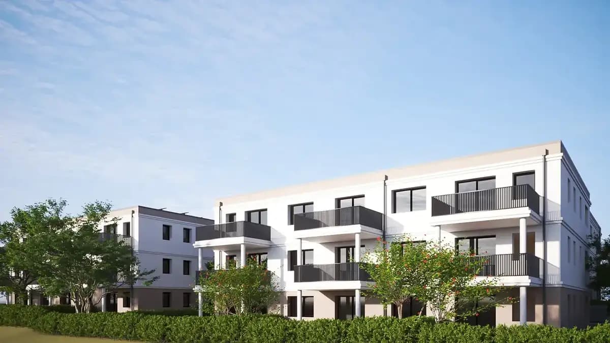
Location Due Diligence
Investors immediately recognize the transport connections and the urban environment.
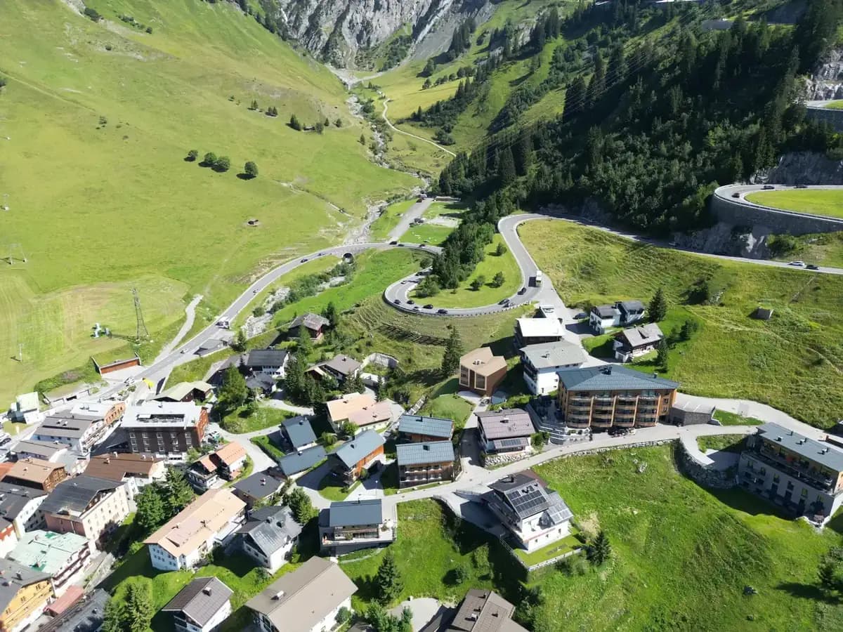
Project Development Vision
Visualization of the dimensions of large-scale properties, business parks, and logistics hubs.
High-End Positioning
Dynamic 4K drone flights signal premium quality and massively increase the asset's attractiveness.
Referenzprojekt Neumünster: Featured Project Neumünster: New-Build Terraced Homes for Young Families
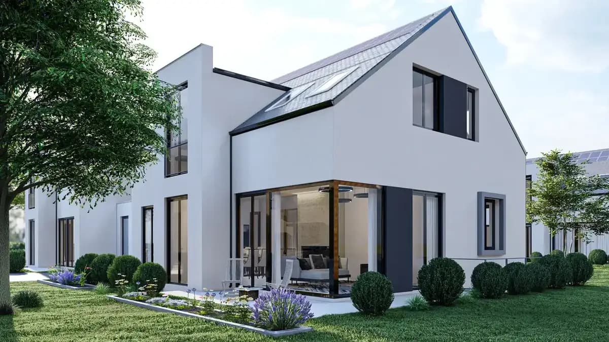
A construction company commissioned us for the sales launch of a new row of terraced houses. Before completion, we delivered 3D renderings of the homes including the garden side, later followed by drone footage of the neighborhood and photography of the show home including a tour. The prospect list filled mainly with families from the Hamburg commuter belt; every unit was sold before construction wrapped up – a result the developer attributed directly to the digital presentation.
So läuft der Termin in Neumünster ab
Wir arbeiten hocheffizient und verlässlich. So läuft das Projekt für Sie ab:
Drone & Aerial Data Capture in Neumünster: was vor Ort zählt
Aus der Luft wird sichtbar, was vom Bürgersteig aus niemand sieht: Grundstückszuschnitt, Nachbarbebauung und die Anbindung des Objekts innerhalb von Neumünster. Wir sind regelmäßig in Neumünster-Nord, Neumünster-West und Neumünster-Ost im Einsatz und kennen die Objekttypen, die dort auf den Markt kommen.
Conveniently located between Hamburg and Kiel, Neumünster attracts commuters and families; attractively visualized listings in Neumünster-Nord or the Neustadt therefore reach a buyer audience far beyond the region. Vor-Ort-Termine in Neumünster lassen sich in der Regel innerhalb weniger Tage einrichten.
Der häufigste Fehler bei Objekten in Neumünster ist, an dieser Stelle zu sparen und dafür später den Angebotspreis zu senken. Die Preisreduktion kostet in der Regel ein Vielfaches dessen, was die Aufbereitung gekostet hätte.
Mission Planning
Checking airspace restrictions and strategic flight planning based on your marketing objectives.
Legal & Compliance
Legally secure obtaining of all official flight clearances and neighbor consents.
Data Capture
Safe execution of the aerial mission by our certified A1/A2/A3 pilots on site.
Post-Processing
Processing of raw data into high-resolution exposé images and dynamic teaser cinematics.
Häufige Fragen (FAQ)
What our partners say
"The digital twins allow us to centrally and efficiently manage our nationwide portfolio from our headquarters."
"The cinematic tours convey not just a picture of the building, but a real sense of life. This goes down extremely well with our buyers."
"Through FotoEstate's 3D visualizations, we significantly shortened our time-to-market and secured our liquidity faster."
"FotoEstate's visual excellence is industry-leading. They help us present our premium properties in the best possible light."
"The 3D floor plans are so detailed that they provide an excellent basis even for complex planning discussions with clients."
"Integrating the Matterport data into our systems greatly simplified communication with our facility management service providers."
"The digital twins allow us to centrally and efficiently manage our nationwide portfolio from our headquarters."
"The cinematic tours convey not just a picture of the building, but a real sense of life. This goes down extremely well with our buyers."
"Through FotoEstate's 3D visualizations, we significantly shortened our time-to-market and secured our liquidity faster."
"FotoEstate's visual excellence is industry-leading. They help us present our premium properties in the best possible light."
"The 3D floor plans are so detailed that they provide an excellent basis even for complex planning discussions with clients."
"Integrating the Matterport data into our systems greatly simplified communication with our facility management service providers."
We also work in these towns and municipalities around Neumünster
On-site appointments for photography, drone shoots and 3D scans are available throughout the region – travel is usually included within this area.
Ihr Projekt in Neumünster – jetzt anfragen
Lassen Sie sich unverbindlich beraten. Wir besprechen die beste Lösung für Ihre Immobilien und Objekte vor Ort in Neumünster.