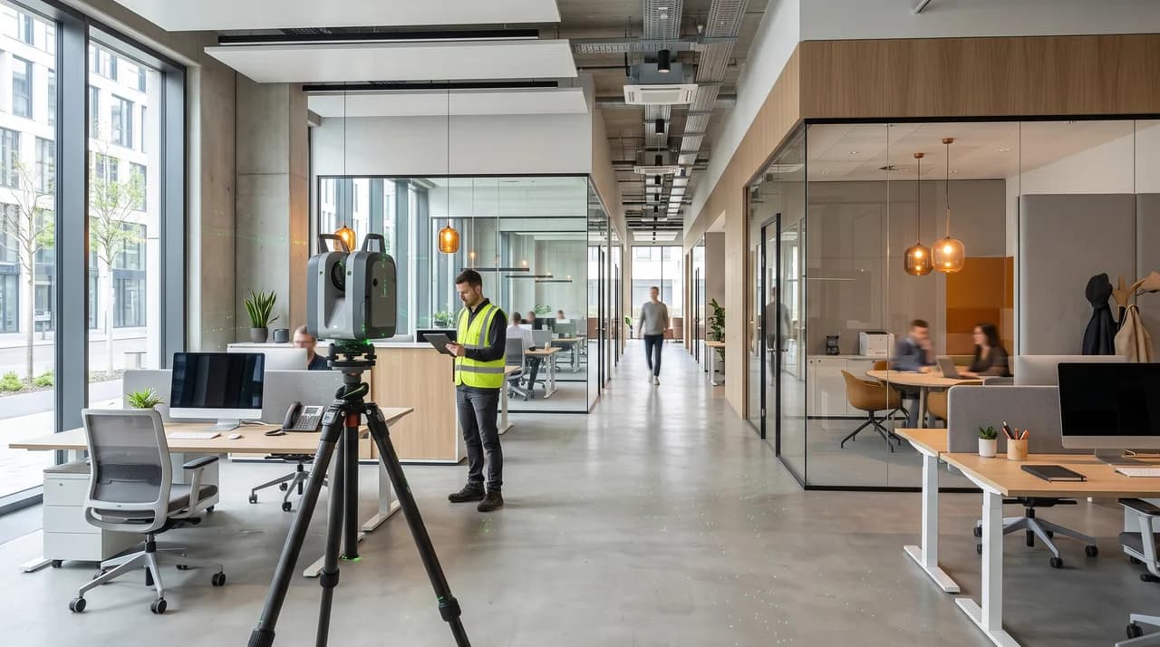
For commercial real estate teams and facility managers, a building is only as manageable as the data you hold about it. When a lease is up for renewal, a floor needs to be re-let, a fit-out is planned or an asset is being prepared for sale, the same question resurfaces: do we actually know what this space looks like, how big it is and how it is laid out? Paper plans are often outdated, area figures are inconsistent between documents, and nobody wants to send a team out with a tape measure across 6,000 square metres of warehouse.
Digital capture solves this by producing a single, reliable record of a property that can be reused across marketing, leasing, planning and operations. But the process is not simply "someone turns up with a scanner". A well-run capture project is a sequence of deliberate steps, each of which shapes the quality and usefulness of the final data. This guide walks through that sequence as it applies to office, retail and industrial assets, so you know what to expect, what to prepare and where the common pitfalls hide.
Start With the Purpose: The Initial Scoping Conversation
Every capture project should begin with a conversation about what the data will actually be used for, because the intended use determines almost every technical decision that follows. A property being marketed for lease needs attractive imagery and an easy-to-navigate virtual tour. A property being prepared for a fit-out needs dimensionally accurate floor plans that an architect can build on. An asset going into a portfolio valuation needs area figures calculated to a recognised standard. These are different jobs, and trying to guess the purpose after the site visit almost always means going back for more data.
In this scoping conversation we clarify a handful of decisive points. Who are the end users of the output, and are they technical or commercial? Do you need certified area figures, or indicative ones? Will the deliverables feed into a CAD or BIM environment, and if so, in which file formats and to which layer conventions? Is there an existing set of drawings we should reconcile against, or are we capturing from scratch? Answering these early lets us right-size the effort rather than over-scanning a simple retail unit or under-capturing a complex industrial site.
The scoping call is also where we surface constraints that would otherwise derail the schedule. Occupied tenancies, restricted areas, live production lines, security clearances, health-and-safety inductions and out-of-hours access all have a direct effect on how and when capture can happen. Getting these on the table at the start means the project plan reflects reality, and the price and timeline you receive are ones we can actually hold to.
Reading the Building: Scan Planning for Office, Retail and Industrial Assets
Once the purpose is clear, we plan the capture around the specific character of the asset, because an office floor, a shopping unit and a distribution hall each behave very differently under a scanner. Scan planning is essentially deciding where the equipment will be positioned, how densely, and in what sequence, so that every relevant surface is recorded with no gaps and no wasted effort. Good planning is what separates a clean dataset from one riddled with shadows and missing corners.
Office space tends to be geometrically busy but physically manageable. Partition walls, glazed meeting rooms, corridors and repeated small rooms create many sight-line breaks, so an office typically needs a relatively high number of scan positions placed close together to see around every corner. Reflective glass, mirrors and glossy surfaces need attention, as they can confuse laser measurement and require careful positioning or supplementary manual measurement. Ceiling voids, riser cupboards and plant rooms are easy to forget but often matter for facilities documentation.
Retail and industrial spaces pose the opposite challenge: large, open volumes where the difficulty is scale and clutter rather than intricate geometry. A retail unit may be captured quickly when empty, but a trading store full of fixtures, stock and shoppers demands a plan for working around merchandise and people. Industrial and logistics buildings bring high ceilings, racking systems, machinery and long clear spans, which call for scan positions arranged to reach up into the roof structure and along aisles without being blocked by pallets. In each case the plan is tailored so the capture team arrives knowing exactly how they will move through the building.
Coordinating Access With Tenants, Security and Facility Teams
The most technically sophisticated scan plan is worthless if the team cannot get into the rooms that matter, which is why access coordination is treated as a core part of the project rather than an afterthought. In multi-tenant commercial buildings, access touches several parties at once: the landlord or asset manager who commissioned the work, the tenants who occupy the space, the facility management team who hold the keys and know the building, and often a security provider who controls entry and monitoring. Aligning all of them around a single capture window takes lead time.
Tenant coordination deserves particular care because it affects both cooperation and data quality. Occupiers understandably want notice, a clear explanation of what will happen, and reassurance about confidentiality, especially where sensitive commercial information, personal workspaces or restricted zones are involved. We agree in advance which areas are in scope, whether desks and documents should be cleared or obscured, and whether capture must happen outside business hours to avoid disruption. A tenant who understands the purpose and feels respected is far more likely to grant clean, unhurried access to every room.
Security and facility coordination is where the practical logistics live. Access cards, sign-in procedures, escort requirements, health-and-safety inductions, permits to work and restrictions on photography in certain areas all need to be settled before the site day, not discovered on it. For industrial sites there may be additional rules around personal protective equipment, exclusion zones near machinery, or supervised access to live operations. When these details are resolved in advance, the capture team works efficiently and safely, and the client is not paying for people standing idle at a locked door.
Two Technologies, One Dataset: Photography Meets Laser Scanning
At the heart of modern digital capture is the combination of two complementary technologies: professional photography for how the space looks, and laser scanning for exactly how big and where everything is. Used together on the same visit, they produce a dataset that serves both the commercial and the technical audience without compromise. Understanding why both are used helps clarify what each deliverable can and cannot do.
Photography, including the panoramic imagery that powers virtual tours, is about persuasion and orientation. It shows the quality of finishes, the feel of the light, the flow between spaces and the overall condition of the asset. For leasing and marketing this is what captures attention and lets a prospective occupier explore a building remotely before committing to a viewing. High-quality imagery also documents the as-found state of a property at a moment in time, which is valuable for condition records and dilapidation discussions at the start or end of a lease.
Laser scanning, by contrast, is about precision. The scanner records millions of measured points to build a point cloud, a dense three-dimensional coordinate model of the building from which accurate distances, areas and heights can be derived. This is the foundation for reliable floor plans and area calculations, because the geometry comes from measurement rather than interpretation of old drawings. When photography and scanning are aligned to the same reference, a single site visit yields both the emotive marketing material and the hard, verifiable numbers, which is far more efficient and internally consistent than capturing them separately.
What You Actually Receive: Typical Deliverables
Once the raw data is captured, it is processed into a set of finished deliverables tailored to the purpose defined at the start. Knowing the typical outputs helps you specify exactly what you need and avoid paying for material you will never use. Three deliverables cover the majority of commercial requirements: a virtual marketing tour, a CAD floor plan, and a standards-based area calculation.
The virtual marketing tour is the client-facing output. It stitches the panoramic imagery into a navigable, browser-based walkthrough that lets prospective tenants, buyers or stakeholders move through the property at their own pace from any device. For leasing teams this reduces wasted viewings by pre-qualifying interest, and it keeps a space marketable even while it is occupied or difficult to access. Tours can usually be embedded in listings, shared by link, and enriched with information points highlighting features such as services, dimensions or available fit-out options.
The CAD floor plan is the technical backbone. Derived from the scan data, it provides accurate walls, openings, columns and core elements in a format that architects, space planners and facilities teams can work with directly, typically as a DWG or similar CAD file alongside PDFs for general distribution. Because it is measured rather than traced from memory, it becomes a trustworthy base for fit-out design, space management, lease plans and stacking diagrams. Accompanying this is the area calculation, which translates the geometry into the square-metre figures that drive rent, valuation and reporting, produced to a recognised standard so the numbers stand up to scrutiny.
Area Calculation to Recognised Standards
Area figures sit at the commercial centre of any property, so it matters enormously that they are produced consistently and to a defined method rather than pulled from mismatched historical documents. Rent, service-charge apportionment, valuation and comparison between assets all depend on area, and a discrepancy of even a few per cent can translate into meaningful money over the life of a lease. Digital capture allows areas to be measured once, accurately, and calculated transparently.
The important principle is that there is no single universal definition of "area", which is precisely why the standard used must be stated explicitly. Different measurement conventions treat elements such as internal walls, columns, circulation space, plant areas and common parts differently, and they distinguish between concepts like gross and net internal areas or lettable and usable space. A figure quoted without its basis is effectively meaningless, so a professional deliverable always names the standard applied and shows how the space has been classified.
Because the calculation is derived from the point cloud and the CAD plan, it is fully traceable: each area can be tied back to measured geometry and to the drawing that defines it. This is what makes the output defensible in negotiations, valuations and disputes. It also means that if a standard needs to be changed or a second basis of measurement is required for a particular audience, the underlying data can be re-processed without another site visit. For portfolios, applying the same method across every asset finally makes the numbers comparable, which is often impossible with legacy documentation.
From Booking to Delivery: A Realistic Project Timeline
Clients frequently ask how long the whole process takes, and while every project differs, a typical commercial capture follows a recognisable rhythm from booking to final delivery. Setting realistic expectations up front avoids the twin problems of impatience and last-minute panic when a capture is needed to hit a marketing launch or transaction deadline.
The first phase is preparation, which usually spans several days to a couple of weeks depending on how many parties are involved. This covers the scoping conversation, the scan plan, and above all the access coordination with tenants, security and facilities. For a single vacant unit this can be very quick; for a large occupied multi-tenant building it is often the longest part of the whole project, because it depends on other people's calendars. Booking early is the single most effective way to compress the overall timeline, since capture and processing cannot start until access is secured.
The on-site capture itself is typically the shortest phase, ranging from a few hours for a small retail or office space to one or more full days for large industrial or multi-floor assets. Processing then follows, turning raw scans and images into finished deliverables. A virtual tour can often be published within a few days, while CAD plans and standards-based area calculations generally take longer because they involve careful drafting and quality checking. As a broad guide, many commercial projects run from booking to full delivery within two to four weeks, with the marketing tour usually available first and the technical documentation following. Rush timelines are possible, but they depend far more on access than on our processing capacity.
Common Pitfalls and How to Avoid Them
Most problems in digital capture projects are avoidable, and they tend to recur in predictable places, so knowing them in advance is the cheapest form of insurance. The first and most common pitfall is under-defining the purpose. When the intended use of the data is vague, either too little is captured to meet a later requirement, or too much is captured at unnecessary cost. A clear brief at the scoping stage prevents both, which is why we invest time there before anyone is booked to attend site.
The second recurring pitfall is access, and it causes more delays than any technical factor. Tenants not notified in time, keys unavailable, restricted areas discovered on the day, missing security clearances or unexpected health-and-safety inductions can all cost a wasted site visit. The remedy is to treat access as a project workstream with named responsible people and confirmed arrangements before the capture date. Related to this is capturing an occupied space in poor condition: clutter, stock, blocked rooms and closed doors leave gaps in the data, so agreeing in advance how spaces will be presented pays off directly in quality.
The third cluster of pitfalls concerns the numbers and the handover. Area figures quoted without stating the standard used cause confusion and disputes, so the basis of measurement must always be explicit and consistent, especially across a portfolio. Equally, deliverables handed over in the wrong file format or without agreed CAD conventions create rework for the receiving architects and facilities teams. Confirming formats, standards and naming conventions during scoping, and doing a short review of the first deliverable together, ensures the output slots straight into your existing systems rather than sitting unused.
Conclusion
Digitally capturing a commercial property is less about the equipment and more about a disciplined sequence: understand what the data is for, plan the capture around the specific nature of the office, retail or industrial asset, coordinate access carefully with tenants, security and facilities, and combine photography with laser scanning so a single visit yields both marketing appeal and measured precision. The result is a coherent set of deliverables, a navigable virtual tour, an accurate CAD floor plan and a defensible, standards-based area calculation that serve leasing, planning, valuation and operations alike.
For commercial real estate and facility managers, the payoff is a single trustworthy record of each asset that removes guesswork from every downstream decision. By defining the purpose early, protecting the access window and insisting on transparent measurement standards, you turn what can feel like a logistical headache into a straightforward, repeatable process, and you end up with property data you can actually rely on for years rather than a folder of drawings nobody trusts.