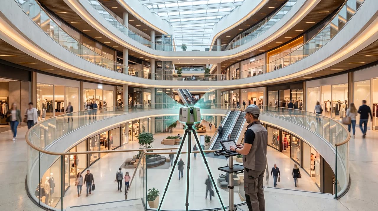
Digitizing a shopping center sounds, at first, like a technical footnote: a few scanners, a couple of nights of work, and the virtual tour is finished. Anyone who has actually managed the digital capture of a mall with 40,000 square metres of retail space, three levels, 120 tenant units and a business that runs seven days a week knows that this is a fundamentally different undertaking from digitizing a single commercial property. The sheer scale does not just multiply the effort; it changes the logistics, the coordination, and the timeline of the entire project.
This article walks step by step through how a shopping center is realistically digitized, from the first floor-area analysis, through the night-time scanning choreography with dozens of tenants, to the finished digital twin that serves simultaneously as a leasing tool and a visitor navigation system. The goal is a practical roadmap that center management and asset teams can use to orient themselves before they put such a project out to tender.
Why Shopping Centers Are Fundamentally Different from Single Properties
For an individual office floor or a single retail unit, a 3D scan can usually be completed in a day or even a few hours. A shopping center, by contrast, is an ecosystem of many legally and operationally independent units under one shared roof. The floor area itself is only half the challenge. Far more demanding is the number of stakeholders who have to be coordinated before a scanner is even set up.
Then there is the multidimensional nature of the building. Unlike an office block with relatively uniform storeys, shopping centers consist of sharply contrasting zones: high-traffic mall corridors, escalators and atriums, food courts with complex furnishings, underground car parks with their own circulation logic, delivery bays, technical rooms, and dozens of individually designed retail units. Each of these zones places different demands on scan density, lighting, and the timing of capture. A blanket approach of "one scanner, one walkthrough" simply does not work here.
Finally, a shopping center is never truly closed. Cleaning crews, security teams, deliveries, and maintenance work continue through the night. The digitization has to fit into this ongoing operation without disrupting it and without inconveniencing tenants or visitors. That is what turns a technical assignment into a project with a substantial organizational component, one where scheduling and communication matter as much as the scanning hardware itself.
Phase 1: Floor-Area Analysis and Scope Definition
Every project begins with a precise survey of the space. The first distinction to draw is between common areas and individual tenant units, because this split later determines contract structure, access rights, and cost allocation. Common areas include mall walkways, entrance halls, escalators, lifts, restrooms, food courts, parking areas, and technical rooms. These fall under the responsibility of center management and can be captured without consulting individual tenants.
The individual retail units are a different matter. Here the lease agreement, or a separate arrangement, usually decides whether and to what extent the unit is digitized. Some centers initially capture only vacant units or those coming up for re-letting, while others opt for a complete scan of every shop in order to build a continuous digital representation of the whole center. This scope decision should be made early, because it directly drives the number of appointments, the volume of tenant communication, and the overall project duration.
This phase also examines the technical starting point: existing CAD plans or floor plans, ceiling heights, lighting conditions, Wi-Fi coverage for mobile scanning devices, and any structural peculiarities such as galleries, split-level areas, or glazed façades that can cause reflection problems during 3D capture. The phase ends with a detailed floor plan showing marked scan zones, an estimated capture time per zone, and a rough window for the overall process. Getting this groundwork right prevents costly surprises once the scanning teams are already on site and working against the clock.
Phase 2: Tenant Communication and Legal Alignment
Once the scope is fixed, the most demanding organizational task of the entire project begins: communicating with the tenants. In a center with 80 or 120 units, this is not a single email but a structured communication process with several touchpoints. A three-step approach has proven effective: a general announcement of the project through the center newsletter or a tenant meeting, an individual letter with a concrete proposed appointment, and finally a reminder 48 to 72 hours before the actual scan.
It is essential to convey the value of the project clearly to tenants. Many shop operators are sceptical at first when strangers are due to enter and record their premises after closing time. It helps to explain concretely what the data will be used for: as the basis for the center website, for virtual tours on marketing portals, for internal space management, and, where desired, as a marketing asset for the tenant themselves, who can then present their own shop in high quality. Framing the project as a shared benefit rather than an imposition dramatically reduces resistance.
In parallel with the content-focused communication, the legal side has to be settled: access rights to each unit outside opening hours, liability questions in the event of damage, rules for handling visible merchandise or sensitive documents, and usage rights to the resulting image and 3D data. These points should be captured in a short, standardized addendum to the lease or in a separate digitization opt-in, so that a bespoke contract does not have to be negotiated for each of the hundred-plus units. A single clean template, agreed with legal counsel once, saves weeks of back-and-forth later.
Phase 3: Security Concept and Night-Time Scanning
The actual capture of a shopping center takes place almost exclusively outside opening hours, usually between store closing and the early morning, when no customers remain in the building and the lighting can be controlled deliberately. In practice this means night shifts over several weeks, coordinated with the center's security service, which grants access, deactivates alarm systems, and stays present throughout the capture.
A robust security concept regulates several things at once: who gets access to which areas and when, how keys or transponders for the many individual units are managed, what reporting channels apply in the event of technical incidents such as triggered alarms, and how it is ensured that every area is returned to its original condition for business the next morning. In centers with an in-house security team, a fixed point of contact is usually named, someone who accompanies the scanning teams through the night and stays in touch with facility management and building services. Without this single accountable person, a night can easily be lost to a locked door no one can open.
Lighting deserves particular attention. During the day, a mix of artificial light and daylight through skylights or glass façades creates shifting conditions that complicate 3D capture. At night, the lighting can be standardized, which yields more even and therefore higher-quality scan results. At the same time, individual shop-window or ceiling lights inside the tenant units often have to be switched on manually, which requires additional coordination with center staff who hold the relevant access. A well-thought-out sequence plan defines the order in which zones are captured, so that lighting technicians and security personnel do not have to shuttle constantly between areas that lie far apart.
Phase 4: The Actual 3D Capture in Practice
Technically, the capture usually proceeds in clearly delimited segments. The common areas are scanned first as a connected whole, because they form the spatial backbone for later navigation within the digital model; every retail unit must eventually dock onto the correct mall section. The individual tenant units follow, generally grouped in blocks by building wing or level in order to minimize the scanning team's travel time between locations.
In multi-level centers, the vertical connection carries particular importance. Escalators, lifts, and stairwells must be captured so that navigation in the finished virtual model transitions seamlessly between floors. A user exploring the digital tour should be able to move intuitively from the ground-floor mall up to the first level without losing orientation, and that requires precise transition points and a consistent alignment of the scan data across every storey. A single misaligned floor break is immediately obvious to anyone using the finished model.
Another practical consideration is dealing with ongoing construction. In larger centers, refurbishments, re-lettings, or seasonal stand changes happen almost continuously. If a unit is rebuilt during the multi-week digitization phase, the schedule has to flex, either by rescanning at the end of the project or through a deliberate order in which stable areas are captured first and zones with planned changes are captured last. Building this flexibility into the plan from the outset avoids the frustration of a freshly captured area becoming outdated before the project even ends.
From Raw Dataset to Walkable Digital Center
Once capture is complete, the raw data is processed into a coherent digital model. For an object of this size, that means joining hundreds of individual scan segments into one consistent whole in which scale, orientation, and the transitions between areas all line up exactly. Errors at this stage, such as a misaligned transition between a mall section and a retail unit, become immediately and unpleasantly apparent during use and can only be corrected with considerable effort.
In parallel with the pure 3D stitching, the data is prepared for different usage scenarios. For center marketing, attractive virtual tours of individual vacant units are produced, giving prospective tenants a realistic sense of size, layout, and surroundings without needing a physical viewing appointment. For internal space management, a precise digital floor plan is created that serves as a reliable reference during refurbishment planning, lease negotiations, or technical inspections. And for the center as a whole, a continuous model emerges that can be used as the basis for visitor orientation and information.
A clear data structure is critical at this point: which areas are publicly accessible and may be shown on the center website, which data remains internal for facility management and leasing, and which individual shop data belongs to the respective tenant for their own use. This separation should already have been established contractually in Phase 2, so that it does not have to be clarified retroactively during data preparation, when untangling it costs far more time than it would have upfront.
Indoor Navigation for Visitors as an Added Benefit
An often underestimated bonus of complete center digitization lies in visitor orientation. Anyone who has ever searched for a specific store in a large, multi-level shopping center knows the problem: conventional overview maps at information kiosks show where a shop is located but give no sense of what the actual surroundings look like or which route reaches the destination fastest. The gap between an abstract diagram and the real space is exactly where shoppers get lost.
On the basis of a complete 3D model, a far more intuitive form of wayfinding becomes possible. Visitors can use a search function to look for a specific store, a category such as "restaurants", or a facility such as toilets or lifts, and receive a visual route through the actually captured building. Instead of an abstract floor plan, they see the real corridor, the real escalator, the real landmarks along the way. This noticeably reduces the frustration of orientation, especially for first-time visitors or in centers with a complex, counter-intuitive layout.
This navigation function can also be linked with further information layers: opening hours of individual shops, current offers, the location of free parking spaces in the underground car park, or notices about temporary diversions during refurbishment work. In this way, a one-off digitization measure becomes a continuously usable service tool that delivers lasting value for visitors and center operators alike, well beyond the single-purpose marketing goal that may have justified it initially.
Vacancy Marketing and Digital Twin as Two Sides of One Investment
One of the most economically compelling properties of complete center digitization is that a single dataset simultaneously serves two entirely different purposes. On one side stands classic vacancy marketing: instead of time-consuming on-site appointments with prospective tenants, virtual tours can be deployed early in the leasing process to ease the shortlisting and to invite only genuinely interested parties to a physical viewing. This saves time on both sides and, in practice, frequently shortens the time-to-lease considerably.
On the other side, the complete capture of the entire center produces a digital twin that reaches far beyond marketing. Facility management teams can use the model to verify floor-area measurements exactly, document technical installations, and plan maintenance without having to re-measure on site each time. When planning refurbishments or restructuring the tenant mix, teams can simulate in the digital model how altered unit layouts affect customer flow before anything is actually built, turning expensive guesswork into an informed decision.
This dual use is what justifies, from a business perspective, the comparatively high initial investment of a center-wide digitization. While capturing individual vacant units already delivers a clear marketing benefit on its own, the value multiplies substantially once the entire center exists as a connected digital representation, from the single leasing decision all the way to the strategic development of the whole asset. Few visual-media investments in commercial real estate offer such a wide spread of downstream uses from one capture campaign.
A Typical Timeline for a Center-Wide Digitization Project
The duration of a complete digitization project naturally depends on center size, but in practice it follows a recurring pattern. The preparation phase, covering floor-area analysis, tenant communication, and contract clarification, usually takes two to three weeks for a mid-sized center, because coordinating with many individual tenants cannot be compressed arbitrarily. In parallel, the security concept is finalized with center management and the security service so that no time is lost once night work begins.
The actual capture phase typically extends over four to six weeks of night work for a center with around a hundred units, depending on how many scanning teams operate in parallel and how flexibly tenants enable short-notice appointments. Larger centers with several hundred units or complex architecture require correspondingly longer, while smaller retail parks with a more manageable tenant mix can shorten the process significantly. Deploying multiple teams is the single biggest lever on this phase.
The final data processing, joining the individual scan segments into a complete model, quality checking, and integrating everything into the website, marketing portals, and, where applicable, the indoor navigation app, takes a further two to four weeks. In total, center managers should realistically plan for eight to twelve weeks from the first planning step to a fully usable digital center. Communicating this timeframe early, and building it into both internal project planning and tenant communication, avoids disappointment and sets realistic expectations for everyone involved.
Conclusion
Digitizing a shopping center differs fundamentally from capturing a single property, not primarily because of the technology but because of the sheer number of stakeholders who must be coordinated. A clean separation between common areas and individual tenant units, early and structured tenant communication, a robust security concept for the night-time capture, and realistic scheduling over several weeks are the decisive success factors.
Anyone who sets this project up correctly ends up with far more than an attractive virtual tour of vacant units. A complete digital twin serves vacancy marketing, internal space management, maintenance planning, and a noticeably improved visitor experience through indoor navigation all at once. Center managers who approach this investment strategically build an infrastructure that continues to generate value for years, long after the original reason for digitizing has been met.