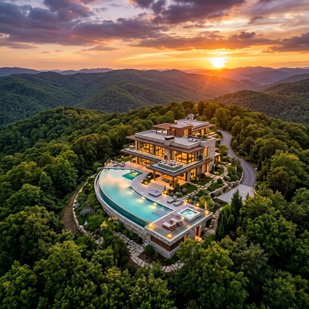
Taken from the air: Why drone footage must not be missing in any exposé
Show the surroundings, the property, and the condition of the roof at a glance. Aerial images provide orientation and exclusive content.
A classic exposé with ground-based photos (even with perfect real estate photography) has always reached its limits for large-scale properties. How does one visualize the expansive dimensions of a logistics park, the exclusive seclusion of a luxury villa, or the transport connections of a commercial plot? The answer lies in the vertical. Professional drone footage (UAS – Unmanned Aircraft Systems) has developed in recent years from an expensive niche product to an absolute industry standard for real estate agents, developers, and project planners. It not only provides breathtaking perspectives for marketing but also tangible, usable data for construction planning and condition documentation. This guide illuminates the entire B2B spectrum of professional drone photography.
1. Micro-location and Macro-location: The environment sells with it
In B2B real estate sales, the old industry motto applies: 'Location, location, location.' An investor does not only buy the building, he buys the infrastructure. Ground-level photos can show the facade design of an office building, but they conceal the context.
High-resolution aerial photographs and drone panoramas provide potential buyers with immediate visual proof of the qualities of macro and micro location:
- Commercial real estate & logistics: A picture from 50 meters high immediately shows the proximity to the nearest highway entrance, turnaround options for heavy traffic in the yard, and the distance to the nearest freight station.
- Project development (off-plan): For empty construction sites, the drone visualizes the future view from the 5th floor (view shots) long before the first excavator rolls. This is a decisive selling point when marketing penthouses.
- Luxury real estate: Drones capture the expansiveness of park-like gardens, private lake access, or the absolute seclusion that would simply not be photographable from the ground.
2. Technical Inspection and Condition Documentation (Due Diligence)
Drones are far more than just marketing tools in the B2B environment. They are flying inspection platforms. In due diligence (the careful examination of an object before purchase), the condition of the roof and the facade plays a central role in price negotiation.
Traditionally, expensive aerial platforms would have to be rented or even scaffolding set up for a roof inspection – a time and cost effort that is often avoided in the pre-sales phase. Certified drone pilots from FotoEstate safely fly even intricate roof structures, chimneys, or high-lying facade parts.
The high-resolution images reveal damage to roof tiles, clogged gutters, or the condition of photovoltaic systems mercilessly. Investors gain immediate transparency over necessary renovation costs (CapEx) through this visual asset management, which builds trust and speeds up the transaction process.
3. Orthophotos and 3D Terrain Models (Photogrammetry)
For architects, surveyors, and property developers, we transform drone footage into precise, measurable data. By automatically flying over a property with hundreds of overlapping individual images, we create exact orthophotos using photogrammetry.
An orthophoto is a distortion-free, to-scale aerial image in which distances, areas, and even volumes (e.g., of earthworks on a construction site) can be measured directly on the computer. In combination with elevation models (Digital Elevation Models), this data can be directly imported into CAD and BIM systems (Building Information Modeling). In this way, the drone provides a highly precise digital planning basis within a few hours, for which traditional surveyors used to need days.
4. Why the Professional Pilot Makes the Difference (Law & Safety)
Real estate offices often have the misconception that an intern with a 500-euro drone from the electronics store can "quickly do" these shots themselves. The risk of this approach is immense:
- Legal Pitfalls (EU Drone Regulation): Commercial drone flight is strictly regulated. Flights over residential properties, near federal roads, hospitals, industrial facilities, or in the control zones (CTR) of airports are strictly prohibited without special official flight permits. Violations result in massive fines.
- Insurance Coverage: Commercial drone flights require a special aviation liability insurance. If a privately flown drone crashes onto a neighbor's parked car, the brokerage office is fully liable.
- Image Quality and Dynamics: The raw images from a hobby drone often appear dull, overexposed, and lacking in dynamics. Only the targeted use of polarizing filters, flying during the "Golden Hour" (sunrise/sunset), and professional post-production (HDR blending, color grading) turn a flat aerial image into an emotional selling point.
Conclusion: The Vertical as a Revenue Turbo
Aerial photography and drone videos are the ultimate proof of an real estate company's innovative power and professionalism. Whether for the highly converting marketing of luxury villas, the technical inspection of industrial roofs, or the surveying of development project plots: the bird's-eye view provides facts where words are not enough.
FotoEstate offers you certified drone pilots nationwide who take care of all approval procedures, fly safely, and deliver breathtaking material. Expand the horizon of your real estate marketing, justify your realtor commission with absolute high-end exposés, and dominate your local market from above.
Related articles
Explore Drone imagery
See what the service includes, which source material is useful and how a typical project starts.