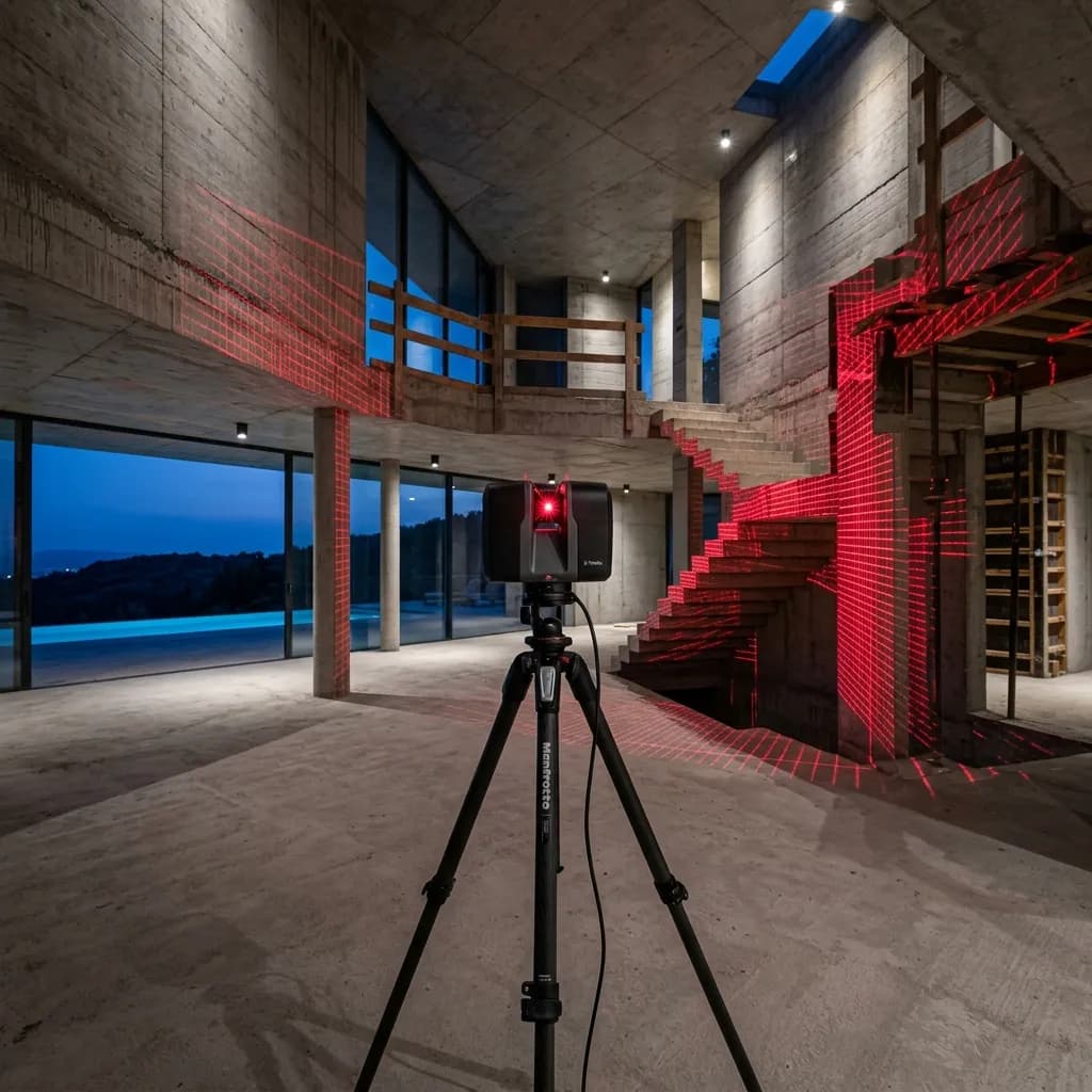
Planning with millimeter precision: The advantages of 3D surveying and laser scanning
Forget manual measurement errors. Learn how highly precise laser scans lay the foundation for smooth digital construction planning (BIM).
Building on existing structures (refurbishment) is the rule rather than the exception in today's architecture and real estate industry. Whether it's the energy-efficient renovation of 1970s schools, the conversion of historic factory halls into modern lofts, or the retrofitting of complex technical building equipment (TGA) in office complexes: the biggest source of errors and the most significant cost driver in such projects is an inadequate or outdated existing data basis. Those who plan based on 30-year-old 2D paper plans or occasional hand measurements using laser distance meters (Distometers) inevitably risk collisions on the construction site. The solution for architects, civil engineers, and general contractors to reduce this planning risk (de-risking) to zero is 3D laser scanning (LiDAR). This article provides an in-depth look at how modern surveying technology ensures the construction process, eliminates change orders, and paves the way for Building Information Modeling (BIM).
1. The End of Manual Measurement: How 3D Laser Scanning Works
Terrestrial 3D laser scanning (Terrestrial Laser Scanning - TLS) has revolutionized surveying. Instead of spending days walking through an object with a tape measure and distance meter, a high-performance scanner (e.g., from Leica Geosystems or FARO) is positioned on a tripod. This sends millions of eye-safe laser pulses into the space per second. Each pulse that hits a surface (wall, pipeline, steel beam) is reflected. Using the time-of-flight or the phase shift of the light, the scanner calculates the exact spatial coordinate (X, Y, Z) of each individual reflection point.
The result is an extremely dense, three-dimensional point cloud. This point cloud is a scale-accurate, digital representation of reality (digital twin). By linking (registering) multiple scan locations, a seamless, millimeter-precise 3D model of the entire building is created – inside and out.
2. The unbeatable advantages for architects and construction managers
The integration of 3D scans into the planning process (service phases 1-5 of the HOAI) offers architecture firms and specialist planners decisive competitive advantages:
A. Absolute geometric truth (as-built capture)
Paper plans are patient, reality is not. In construction, no wall is perfectly at a 90-degree angle, no ceiling completely flat. Old plans document what was once approved, but not what has actually been rebuilt or improperly repaired over the decades. 3D scanning documents the uncompromising as-built condition. Deformations in historic roof trusses, sagging ceilings, or subsequently added load-bearing walls are recorded down to the centimeter.
B. Massive time savings and completeness
A classic manual measurement is not only prone to errors, it also forgets details. Often, the architect only realizes weeks later in the office that the parapet height of a certain window on the second floor was not measured – which requires an additional, costly trip to the construction site. A 3D scanner blindly captures 360 degrees of everything that is visible. The measurement is complete. Every detail, whether needed or not, is frozen in the point cloud and can be conveniently re-measured digitally later on the monitor.
C. Contactless Detection of Risk Areas
In industrial or heritage conservation, there are areas that are life-threatening or inaccessible (e.g., hot pipelines, roofs at risk of collapse, deep shafts). Since the laser beam often has a range of over 100 meters, these zones can be scanned from a safe distance. Also in monument protection and in the documentation of churches & sacred buildings, the completely contactless recording of delicate stucco or historical frescoes is an indispensable criterion.
3. The Gamechanger: Scan-to-BIM and Clash Detection
The point cloud is a powerful reference, yet its true potential unfolds in the so-called Scan-to-BIM process. In this process, the cloud, containing millions of points, is imported into native CAD and BIM software (e.g., Autodesk Revit, ArchiCAD, or Allplan).
Experienced designers at FotoEstate use the point cloud as an exact template to trace parametric 3D components (walls, supports, windows). The result is an intelligent, semantic BIM model (in IFC format) that can be used collaboratively by all specialist planners (architecture, structural engineering, building services).
This digital workflow enables clash detection on the monitor. Suppose the MEP planner is designing a new, 40 cm thick ventilation duct in a factory hall. By overlaying their design with the scanned as-built point cloud of the hall, they can immediately see on the PC whether their duct collides with an existing steel beam. This problem is solved virtually in the office long before the installer is on site and realizes that the pipes do not fit.
4. ROI (Return on Investment): Avoidance of expensive additional charges
Many builders initially shy away from the costs of a 3D laser scan and commission a cheaper, manual measurement instead. This reasoning is a fallacy. The costs for a 3D measurement are usually in the per mille range of the construction sum. A single planning error caused by incorrect existing data – for example, if prefabricated steel components or custom-made glass facades do not fit on the construction site and have to be reproduced – causes costs that exceed the price of the scan many times over. In addition, there is a risk of massive construction delays, contractual penalties, and legal disputes with general contractors due to additional claims. 3D scans are the most effective insurance against construction risks.
Conclusion: Digital transformation allows no compromises
The digitization of the construction industry is in full swing. Those who want to win public tenders (VgV) in the future or economically manage complex renovation projects for institutional investors cannot avoid BIM and thus precise 3D as-built data. FotoEstate provides architects, planners, and facility managers across Germany with exact 3D laser scans and intelligent BIM models. We minimize your planning risk, accelerate your processes, and create a foundation on which you can literally build to the millimeter.
Related articles
Explore 3D surveying & laser scanning
See what the service includes, which source material is useful and how a typical project starts.